Marine Survey Technology
Acoustic Backscatter Classification: Mapping Seafloor Sediment From the Strength of an Echo
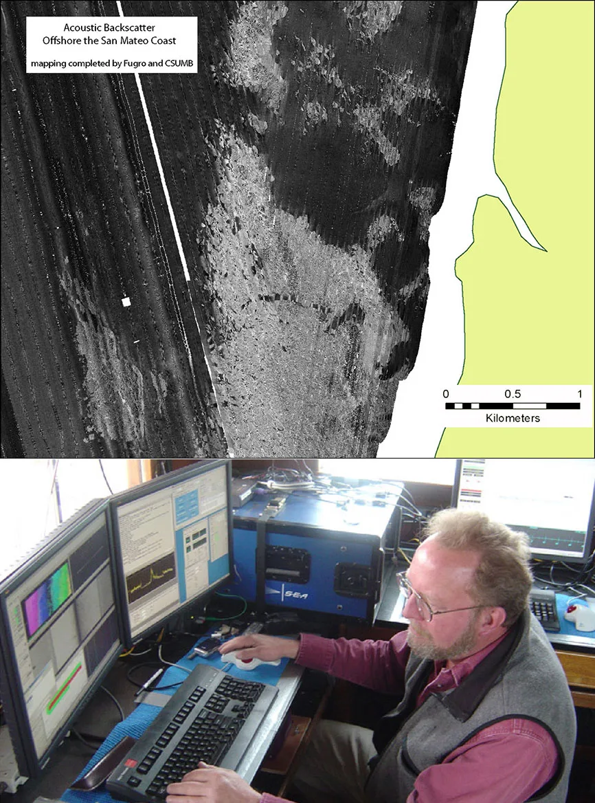
A multibeam or side-scan survey doesn't just measure depth — every ping that comes back also carries a signal strength, and that signal strength changes with what the sound bounced off. Rock reflects differently than mud. Gravel reflects differently than fine sand. Acoustic backscatter classification is the set of techniques that reads seabed composition out of that reflected signal, turning a survey's full-coverage sound data into a sediment map without needing a physical sample pulled up at every single point.
From Echo Shape to Seabed Type
Before multibeam echosounders were common, surveyors already knew that an echosounder's return echo carried more information than depth alone — its shape changed depending on what it reflected off. A system developed in the United Kingdom in the late 1980s and published by Chivers, Emerson, and Burns in 1990 turned that observation into a practical tool. Commercialized as RoxAnn by Marine Micro Systems of Aberdeen, Scotland, it worked by splitting a single-beam echosounder's return into two energy measurements: E1, the partial integration of the tail of the first echo, related to seabed roughness; and E2, the full integration of a second echo that had bounced seabed–surface–seabed, related to hardness. A few years later, a digital, software-based competitor called QTC-View arrived, applying similar physics through signal processing rather than dedicated analogue hardware. Both were, at their core, acoustic ground discrimination systems — instruments riding on an existing echosounder rather than replacing it, extracting seabed type from an echo that was already being recorded for depth.
What Backscatter Actually Measures
Backscatter is the portion of an acoustic pulse that returns to the sonar's receiver after being absorbed, reflected, and scattered by the seabed. How much of that energy comes back, and in what pattern, depends on the frequency of the sound, the angle at which it strikes the bottom, and the physical properties of the seabed itself — grain size, density, roughness, and how much of the pulse penetrates into the sediment before scattering back out (volume scattering) rather than reflecting straight off the surface. A hard, rough bottom like rock or coarse gravel tends to return a strong, bright signal; soft, smooth sediment like mud tends to return a weaker, darker one. That single relationship — signal strength as a rough proxy for seabed hardness and roughness — is what every acoustic classification method since RoxAnn has tried to make more precise and more reliable.
From Single-Beam to Full-Swath: The Multibeam Era
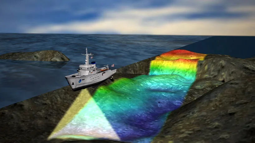
Multibeam echosounders (MBES) changed the scale of the problem. Instead of one narrow beam recording an echo shape directly below the ship, an MBES records backscatter across an entire swath, at a continuously varying incidence angle from directly beneath the transducer out to the edge of the swath. That variation turns out to be useful in its own right: the way backscatter strength changes with incidence angle — its angular response — is treated as an intrinsic property of the seabed, one that correlates with mean grain size closely enough to be used as a predictor of it. More recently, "multispectral" MBES systems that record backscatter at more than one operating frequency have been developed to add another dimension of discrimination; a North Sea study found that combining a low frequency (around 30 kHz) with higher frequencies (95–300 kHz) improved sediment and habitat discrimination over any single frequency alone.
Turning Backscatter Into a Classification Map
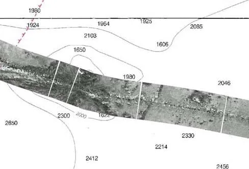
Raw backscatter strength alone is noisy and depends heavily on how it was acquired, so most of the actual classification work happens after collection. Bayesian acoustic sediment classification methods work from at least three geoacoustic parameters — mean grain size, a roughness parameter, and a volume scattering parameter — derived from the backscatter data, then assign each part of the seabed to the sediment class it statistically resembles most. Machine learning approaches have pushed this further: supervised methods, such as Random Forest models trained on angular response curve derivatives, have been used to classify benthic habitat types, with the inclusion of angular response features improving classification accuracy from roughly 88.5% to 93.6% in one comparison. Unsupervised approaches, combining a self-organizing map with hierarchical clustering, have been used to group seabed areas into angular response "facies" without needing labeled training data at all. None of this happened by accident — after a 2013 workshop concluded that backscatter acquisition and processing were still too inconsistent between systems and operators, the GeoHab Backscatter Working Group was formed specifically to standardize practice, publishing its guidelines and recommendations in May 2015.
Where This Matters in Practice
For offshore engineering, backscatter-derived sediment maps feed directly into foundation design, cable and pipeline route planning, and scour risk assessment, because knowing whether a seabed is soft mud or hard rock changes how a structure or cable interacts with it. For dredging, the same classification distinguishes material that's economical to remove from material that isn't, before a single bucket touches the bottom. For environmental work, it supports benthic habitat mapping at a scale that would be impractical to achieve through sampling alone, feeding conservation planning and regulatory assessments. None of this eliminates ground-truthing entirely — studies still pair backscatter classification with physical grab samples or cores (Van Veen grabs, in one North Sea case study) to calibrate and validate the acoustic classes — but it changes the ratio dramatically: a survey that would once have needed a dense grid of physical samples across an entire area can instead collect backscatter across full coverage and validate it against a comparatively sparse set of ground-truth points. One study in the eastern English Channel, combining backscatter, bathymetry, slope, and rugosity into a single classification, reported 88.2% overall accuracy against ground-truth data.
Conclusion
A multibeam echosounder was already recording backscatter long before anyone had a good way to use it — for years it sat alongside bathymetry as a byproduct of the survey rather than a product in its own right. What changed, from RoxAnn's two-number echo shape analysis in 1990 to today's multispectral, machine-learning-assisted classification, is how much can be reliably read out of that signal without stopping the vessel to take a sample. The physical sample hasn't disappeared from marine survey — it still calibrates every acoustic model that depends on it — but it no longer has to be everywhere the survey needs an answer.
References
- Hamilton, L.J. — Acoustic Seabed Classification Systems, Defence Science and Technology Organisation
- GeoHab Backscatter Working Group — Backscatter Working Group
- Lurton, X., Lamarche, G., et al. — Backscatter Measurements by Seafloor-Mapping Sonars: Guidelines and Recommendations
- MDPI Geosciences — Seafloor Characterization Using Multibeam Echosounder Backscatter Data: Methodology and Results in the North Sea
- MDPI Geosciences — A Multispectral Bayesian Classification Method for Increased Acoustic Discrimination of Seabed Sediments
- ScienceDirect — Predictive Mapping of Seabed Cover Types Using Angular Response Curves of Multibeam Backscatter Data
- Frontiers in Remote Sensing — Integrating Angular Backscatter Response Analysis Derivatives Into a Hierarchical Classification for Habitat Mapping
- ICES Journal of Marine Science — Acoustic Classification of Seabed Habitats Using the QTC VIEW System
- GeoGarage Blog — Utilizing Hydrographic Backscatter Data
Related Articles