Hydrography
Crowdsourced Bathymetry Turns Ordinary Ships Into Depth Sensors
Crowdsourced bathymetry (CSB) is depth data collected by ordinary ships with the echosounder and satellite positioning they already carry. Cargo ships, fishing boats, cruise ships and yachts all contribute. This article explains how the data is collected, where it is stored and how reliable it is. It also shows how a project owner can use it for screening, not as a replacement for a proper survey.
Why the seabed still needs ordinary ships
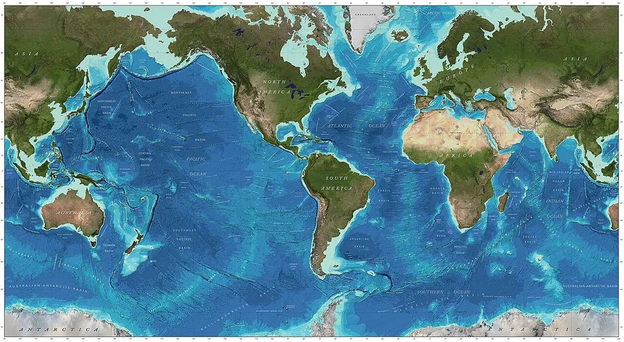
Only about a quarter of the world's seafloor has been measured directly. Most of the rest is estimated, largely from satellite gravity data. The GEBCO 2025 grid counts 27.3% of the seafloor as mapped to modern standards. An IHO report cited in the CSB guidance states that about half of coastal waters shallower than 200 m have not been surveyed.
Meanwhile, thousands of ships measure depth every day. The SOLAS convention requires merchant ships to carry an echosounder and a satellite navigation system. The International Hydrographic Organization (IHO) saw this fleet as an untapped source of depth data. In 2014 it set up a working group that produced guidance document B-12. The current version is B-12 Edition 3.0.0 (2022). It is technical guidance and does not replace national or international law.
How crowdsourced bathymetry data is collected
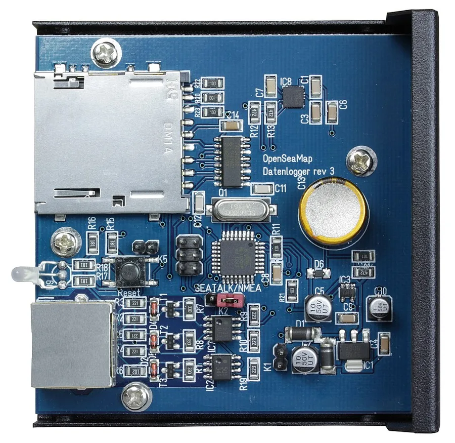
Each measurement has two parts: a depth from the echosounder and a position from GNSS (satellite positioning, such as GPS). Most ships already have both. They usually only need a data logger, or logging software switched on. A data logger is a small device or program that records the output of the echosounder, the GNSS receiver and, if fitted, a motion sensor.
Marine electronics send their readings as NMEA 0183 messages, a standard text format. The logger can run inside an ECDIS, the ship's electronic chart system, or as a stand-alone plug-and-play unit. It must keep accurate time, so that every depth reading has its own position and time stamp.
The minimum data set is position, depth in metres and a UTC time stamp, delivered as CSV or GeoJSON. B-12 prefers raw data "as is", without tide correction. Offsets and context are recorded so that later users can apply corrections themselves. The data is rarely urgent and can even travel on a USB stick.
Trusted nodes and the IHO data centre
Individual sailors cannot be expected to learn data formats, so B-12 uses "trusted nodes". A trusted node is an approved organisation or person that collects CSB data from vessels and forwards it to the IHO Data Centre for Digital Bathymetry (DCDB). It may supply loggers and support, but it does not correct or clean the data.
The DCDB was founded in 1990 and is hosted by NOAA's National Centers for Environmental Information (NCEI). It holds more than 70 TB of multibeam and single beam data from many sources. CSB data is released under a CC0 public-domain licence and can be viewed on the DCDB map viewer or downloaded through NOAA Open Data on AWS. B-12 calls this a "user-beware" basis: the user must judge whether the data fits the job.
A 2025 DCDB update to the IHO working group reported 41.8 GB of public CSB data from 14 trusted nodes and 483 vessels. Rose Point Navigation Systems supplied 81% of it.
The link to Seabed 2030 and GEBCO
The DCDB is the long-term archive for GEBCO and for Seabed 2030, a joint project of the Nippon Foundation and GEBCO. Seabed 2030 aims for a definitive map of the world's seafloor by 2030 and provides simple loggers to local vessels working near the coast. Since June 2022, the International SeaKeepers Society has also placed loggers on private yachts for the project. One listed project is the yacht Aqua Blu, which operates in the Coral Triangle of eastern Indonesia.
Quality limits you need to understand
A ship's echosounder is a navigation tool, not a calibrated survey system. B-12 lists the main error sources.
- Sensor offsets. The GNSS antenna and the transducer sit in different places on the hull. An uncorrected vertical offset biases every depth. An uncorrected horizontal offset shifts seabed features along the track.
- Draft changes. Cargo, fuel and stores change how deep the transducer sits. Depths then read too deep or too shallow. B-12 advises recording draft at the start and end of each voyage.
- Tide. CSB depths are usually not reduced to chart datum. Users must apply tide corrections later using the time stamps. Our article on vertical datums and tidal correction explains why this matters.
- Sound speed. If the echosounder assumes a fixed sound speed, readings can look consistent but still be wrong. They are precise (repeatable) but not accurate (close to the true value).
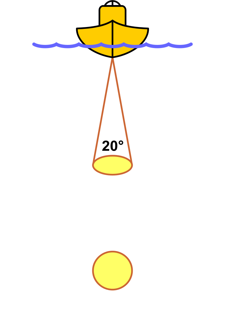
A 2023 paper by Payne of the UK Hydrographic Office states that most CSB today comes from single beam echosounders that are not fully calibrated or corrected. If charted, such data would usually fall into CATZOC D. CATZOC is the quality rating a chart gives to its source data. B-12 itself warns that CSB may not meet accuracy needs where under-keel clearance is critical. A test by the French hydrographic office SHOM, reported in the same paper, found commercial OLEX data unsuitable for charting at critical depths under 40 m. It could, however, fill gaps in deeper water.
How hydrographic offices use CSB
For systematic survey work, B-12 points to IHO C-13 and IHO S-44 Edition 6, the survey standard. Offices check CSB quality partly to decide whether an uncharted hazard needs a navigational warning.
Payne's review of the North Sea region describes a cautious approach. The regional working group agreed that CSB is generally unsuitable for charting in many areas. Its main value is in survey planning: spotting differences from the chart and watching for change. Ferries and other ships on fixed routes give repeated measurements that can show where the seabed moves fast. The paper warns that the uncertainty can be as large as the movement itself. Most offices also do not actively seek CSB, because checking its quality takes staff time.
The position in Indonesian waters
Pushidrosal's 2022 national report to the IHO regional commission discussed only satellite-derived bathymetry in its section on crowdsourced and satellite data. It named no CSB programme. Indonesia is not listed on the 2025 edition of the IHO "Positive List" of states that accept CSB in their waters. The Philippines is listed, for shipping routes and transit passages only. Under B-12, CSB from the waters of a state that has not notified the IHO is held but not published.
What crowdsourced bathymetry means for project owners
Use CSB for early screening. It can show that an official chart may be out of date, flag a possible hazard, fill a gap in a remote area or help decide where to survey first. Do not use it for engineering design, under-keel clearance or dredging volumes. The savings come from better survey priorities, not from skipping the survey.
If a contractor uses CSB as supporting data, ask for:
- the source and date of the data, and its licence;
- which corrections were applied: tide, draft, offsets and sound speed;
- an uncertainty estimate and a consistency check against crossing lines or other data;
- verification survey lines at key locations.
Common mistakes include treating CSB depths as ready to use, ignoring the vessel's draft history and forgetting survey permits in national waters. An empty area on the DCDB viewer may also hide data that is simply unpublished.
Crowdsourced bathymetry gives wide, free and frequently updated coverage, and it is useful for finding outdated charts and planning where to survey. It remains user-beware data and does not replace a survey to IHO S-44. When your project needs depths you can design and navigate on, see our hydrographic and bathymetric survey services.
References
- IHO, "B-12 Guidance on Crowdsourced Bathymetry, Edition 3.0.0," International Hydrographic Organization, 2022, https://iho.int/uploads/user/pubs/bathy/B_12_CSB-Guidance_Document-Edition_3.0.0_Final.pdf
- NOAA NCEI, "IHO Data Centre for Digital Bathymetry (DCDB)," NOAA National Centers for Environmental Information, https://www.ncei.noaa.gov/iho-data-centre-digital-bathymetry
- GEBCO, "Release of the GEBCO_2025 Grid," GEBCO, 2025, https://gebco.net/news/release-gebco2025-grid
- IHO, "IHO Crowdsourced Bathymetry Initiative," International Hydrographic Organization, 2025, https://iho.int/en/iho-crowdsourced-bathymetry-initiative
- P. Payne, "Crowdsourced bathymetry and its use to support resurvey activity in the North Sea region," International Hydrographic Review 29(2), 2023, https://doi.org/10.58440/ihr-29-2-n16
- Pushidrosal, "National Report from Indonesia to the SWPHC-19," IHO South West Pacific Hydrographic Commission, 2022, https://iho.int/uploads/user/Inter-Regional%20Coordination/RHC/SWPHC/SWPHC19/SWPHC19-07N-National%20Report_Indonesia.pdf
- IHO, "Acceptance of Crowdsourced Bathymetry Activities and Provision of Resultant Datasets in National Waters of Jurisdiction (Positive List), v12," International Hydrographic Organization, 2025, https://iho.int/uploads/user/Inter-Regional%20Coordination/CSBWG/MISC/B-12_2025_EN_Acceptance_of_CSB_Data_in_NWJ_v12.pdf
- NOAA NCEI/CIRES (Cartwright, Jencks, Campbell, Cain), "IHO Data Center for Digital Bathymetry: An update," IHO CSBWG16, 2025, https://iho.int/uploads/user/Inter-Regional%20Coordination/CSBWG/CSBWG16/CSBWG16-2.2_2025_EN_DCDB%20Report%20Presentation.pdf
- International SeaKeepers Society, "Seabed 2030 Project," SeaKeepers, https://www.seakeepers.org/?p=54266
Related Articles