Marine Survey Technology
Geohazards in Marine Construction: Why Survey Comes Before Engineering
Every instrument covered in this series so far — side-scan sonar, sub-bottom profiler, multibeam and single-beam echosounders, marine magnetometers — exists for a reason that is easy to lose sight of once you're deep in beam widths and frequency trade-offs: the seafloor is not a passive, static surface waiting for a pipeline, cable, or wind turbine foundation to be placed on it. It moves, fails, leaks gas, hides unstable slopes, and conceals obstructions that were never meant to be found the hard way. Geohazard assessment is the discipline of finding all of that out before construction starts, not after.
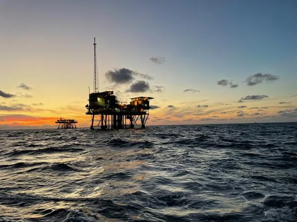
What Counts as a Marine Geohazard?
A marine geohazard is generally defined as any active geological event — a landslide, a rupture along a fault — or passive geological attribute, such as an irregular or steeply sloping seafloor, capable of damaging offshore infrastructure or complicating its construction. A 2019 bibliometric review published in the journal Geosciences, which analyzed 183 peer-reviewed publications indexed in Web of Science and Scopus, sorted the field into 12 distinct hazard categories and found that slope failure and seabed fluid flow (the leakage of water, light hydrocarbons, and sediment through the seafloor) were, by a clear margin, the two most heavily studied. That imbalance is not academic trivia — it reflects which hazards have caused the most expensive lessons in the offshore industry.
When Geohazards Meet Infrastructure: Two Case Studies
The Storegga Slide, off the coast of Norway, is the largest known exposed submarine landslide on Earth — a collapse spanning roughly 290 km of continental shelf and involving an estimated 3,500 km³ of debris, which triggered a tsunami that struck the coastlines of northern Europe approximately 8,150 years ago. It remains the reference case for what a large-scale slope failure is capable of. A 2023 reassessment published in Communications Earth & Environment, using new sub-bottom echosounder profiles, found that a substantial portion of sediment long attributed to the tsunamigenic Storegga event had actually failed roughly 20,000 years earlier, in a separate slide now named after the Nyegga area. The revision matters for more than the history books: it implies that major slope failures along that margin occur more frequently than previously assumed, which directly raises the long-term hazard rating for any infrastructure planned in the region today.
A more recent and far more immediate example came on December 26, 2006, when a magnitude-7.0/6.9 earthquake doublet struck off southwest Taiwan near Hengchun. The shaking triggered submarine landslides in the Kaoping Canyon that generated turbidity currents — dense, fast-moving underwater sediment flows — reaching estimated speeds of up to 20 m/s and traveling roughly 330 km across the seafloor. In the hours that followed, multiple submarine telecommunications cables were severed in sequence as the flow swept down the canyon and out across the Manila Trench system, part of at least five major international cable systems damaged that night. The disruption cut Taiwan's international calling capacity to around 40% and disrupted internet connectivity and financial trading across large parts of East and Southeast Asia for days. No engineering design flaw caused that outage — a geological process nobody had built into the route risk model did.
The Hazard Catalogue
Slope failure and mass wasting
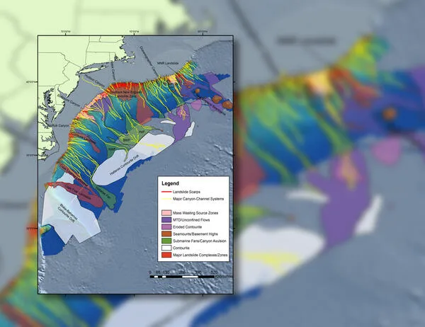
Beyond the historical extremes, slope failure is an ongoing, present-day operational problem. In the Mississippi River Delta Front, underwater mudslides — gravity-driven flows of sediment-water mixtures moving downslope — have repeatedly damaged pipelines and platforms, and have displaced historic shipwrecks by hundreds of meters. The USGS-led Offshore Analysis of Seafloor Instability and Sediments (OASIS) project, an interagency effort coordinated with the Bureau of Ocean Energy Management, has surveyed roughly 1,115 km² of that delta front across expeditions in 2017, 2022, 2023, and 2024 — the first comprehensive high-resolution mapping of the area since 1980 — combining bathymetric surfaces, sub-bottom profiles, and sediment cores to characterize exactly where and how the seafloor is still moving.
Shallow gas, pockmarks, and fluid flow
Shallow gas trapped in near-surface sediment, along with abnormally pressured shallow water flows, is dangerous chiefly because it is invisible until a drill or a foundation installation encounters it. Pockmarks — crater-like depressions on the seafloor left by escaping gas or fluid — are the visible surface signature of that same fluid-flow system, and their presence is treated in petroleum exploration as a direct indicator of subsurface hydrocarbon plumbing that also carries geohazard risk for anything built above it.
Faults and seismicity
Not every fault mapped beneath the seafloor is an active threat — a 2021 USGS and Bureau of Ocean Energy Management study offshore Morro Bay, California, mapped faults, folds, pockmarks, and submarine channels across federal waters between Monterey and Point Conception specifically to support planning for floating offshore wind development, and concluded that most of the mapped faults were pre-Quaternary and unlikely to present a significant current hazard. The more consequential risk identified in that same study was mass wasting along steep features like the Santa Lucia Bank slope during earthquake shaking — underscoring that fault mapping and slope-failure assessment usually have to be read together, not separately.
Scour
Scour — the erosion of sediment around a foundation caused by accelerated current flow — is a slower-moving hazard until it suddenly isn't. A documented case at an offshore wind turbine monopile foundation recorded a scour hole that collapsed abruptly, moving an estimated 450 m³ of seabed material in roughly 75 minutes, a scale of sudden sediment loss that can undermine a foundation's design assumptions well within its operating lifetime.
Seabed obstructions: boulders and UXO
Boulders, glacial erratics, and unexploded ordnance are geohazards of a more mundane but no less costly kind: physical obstructions that can halt a cable-lay or foundation installation outright if they are discovered only when the equipment reaches them. As covered in more depth in this series' article on marine magnetometers and gradiometers, magnetic surveying remains the standard method for locating buried ferrous UXO ahead of offshore wind and cable projects, typically run alongside side-scan sonar to catch non-ferrous obstructions such as boulders in the same survey pass.
Anticipation Through Survey: The Real Point of All This
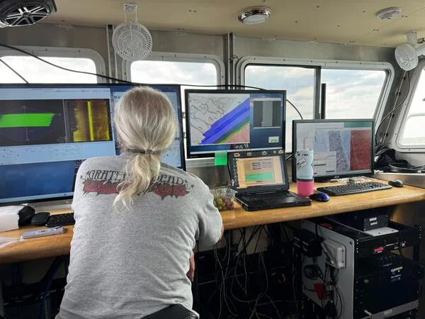
Every hazard described above shares one property that matters more than any other to a project's budget: it is far cheaper to detect during survey than to discover during construction, and immeasurably cheaper than to discover after the asset is already in the water. That is the entire logic behind a staged geohazard assessment workflow — a desktop study of existing data, followed by a geophysical survey campaign, followed by targeted geotechnical investigation, followed by an integrated risk assessment that engineers actually design against. The geophysical stage is where the instruments covered elsewhere in this series do their real work together: multibeam echosounder bathymetry reveals slope angle, seafloor roughness, and scour features; side-scan sonar images boulders, debris, and other surface obstructions; sub-bottom profilers penetrate the seafloor to reveal shallow gas, buried channels, and near-surface faulting; and magnetometers or gradiometers flag ferrous obstructions and UXO that no acoustic instrument can see. None of those instruments individually tells the whole geohazard story — the assessment only works because they are run as a coordinated suite.
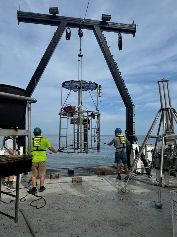
Geophysical survey narrows down where the risks are; geotechnical investigation — boreholes, cone penetration tests, and sediment coring — confirms what the ground actually is at those specific locations, governed for offshore oil, gas, and lower-carbon energy structures by ISO 19901-8 (marine soil investigations, second edition 2023) working alongside ISO 19901-10 (marine geophysical investigations), with DNV-RP-C212 and DNV-ST-0437 providing the parallel geotechnical and site-condition standards widely referenced in offshore wind foundation design. The Morro Bay study cited earlier is a clean, current example of the sequence working as intended: sub-bottom seismic profiles, bathymetry, and piston, gravity, and vibracore sampling across seven surveys in 2018–2019, feeding directly into marine spatial planning for floating wind turbines before a single foundation design was finalized.
Conclusion
None of the geohazards described here are exotic or rare — slope failure, shallow gas, active faults, scour, and buried obstructions show up, in some combination, on almost every offshore route or site worth building on. What separates a routine survey finding from a Hengchun-scale outage or a Mississippi Delta pipeline repair bill is simply whether the hazard was mapped before construction or discovered during it. That is the case, stated as plainly as possible, for treating hydrographic and marine geophysical survey not as a compliance checkbox ahead of an offshore project, but as the first and cheapest line of engineering defense a marine construction project has.
References
- (2019) — Marine Geohazards: A Bibliometric-Based Review, Geosciences, Vol. 9, No. 2
- Walton, M.A.L., Paull, C.K., Cochrane, G.R., Addison, J.A., Gwiazda, R., Kennedy, D.J., Lundsten, E.M., Papesh, A.G. (2021) — California Deepwater Investigations and Groundtruthing (Cal DIG) I: Fault and Shallow Geohazard Analysis Offshore Morro Bay, USGS/BOEM
- Journal of Civil Structural Health Monitoring (2025) — Scour Assessment for Offshore Wind Turbines: A State-of-the-Art Review
- Communications Earth & Environment (2023) — Revised Storegga Slide Reconstruction Reveals Two Major Submarine Landslides 12,000 Years Apart
- Wikipedia — Storegga Slide; 2006 Hengchun Earthquakes; Submarine Landslide
- International Organization for Standardization — ISO 19901-8:2023, Marine Soil Investigations; ISO 19901-10:2021, Marine Geophysical Investigations
- DNV — DNV-RP-C212, Offshore Soil Mechanics and Geotechnical Engineering; DNV-ST-0437, Loads and Site Conditions for Wind Turbines
- USGS — Marine Geohazards; Offshore Analysis of Seafloor Instability and Sediments (OASIS)
- Open Access Government — Types of Marine Geohazards Investigated in Offshore Wind Farm Construction