Marine Survey Technology
Applications of Single-Beam Echosounders: The Simpler Tool That Never Went Away
Multibeam echosounders get most of the attention because they paint an entire swath of seafloor with every ping. But ask a surveyor working a narrow river channel, a small reservoir, or a tight-budget dredging job which instrument is actually on the boat, and the answer is often the much older, far simpler single-beam echosounder (SBES) — a device that fires one pulse straight down and reports one number: the depth right here, right now.
How Single-Beam Echosounders Work
The transducer emits a short acoustic pulse straight down, typically at a beam width anywhere from a narrow 3–6° to a much wider 15–25° or more depending on the model, and depth is derived from the simple relationship D = (c × t) / 2, where c is the speed of sound in water and t is the two-way travel time of the returning echo. Because a single point is measured with every ping — rather than an entire swath — the processing burden is minimal: a continuous depth trace along the vessel's track, not a dense point cloud requiring statistical surface-fitting.
Frequency selection follows the same physics as every other echosounder: higher frequencies attenuate faster but resolve finer detail, lower frequencies travel farther through the water column. A peer-reviewed dataset compiled from 25 survey expeditions across the Russian sector of the southeastern Baltic Sea between 2004 and 2018 illustrates just how precise dual-frequency single-beam instruments have become — a Simrad EA-400SP system operating at 38 and 200 kHz achieved measurement accuracy of roughly 5 cm at the lower frequency and 1 cm at the higher one, while a Furuno FS-700 unit on the same frequencies delivered accuracy on the order of 0.1 m or 2% of depth. That same dual-frequency principle has a practical field use beyond accuracy: in dredging areas where resuspended sediment clouds the water column, the lower-frequency channel can penetrate the loose, resuspended layer to find the undisturbed hard bottom underneath, while the high-frequency channel tracks the top of the softer material.
A Century of Vertical Soundings
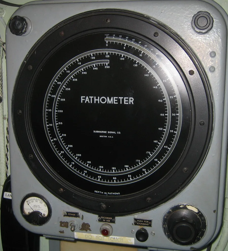
Echo sounding traces back to a rather grim motivation: after the sinking of the RMS Titanic on April 15, 1912, German physicist Alexander Behm began experimenting with reflected sound waves as an iceberg-detection system. Icebergs turned out to reflect sound poorly, but the seafloor did not — and Behm was granted German patent No. 282009 for echo sounding on July 22, 1913. Canadian-American engineer Reginald Fessenden was pursuing the same idea independently in North America around the same time, and his oscillator design became the basis for the earliest commercial "Fathometer" units built by the Submarine Signal Company.
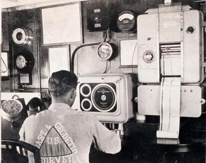
The U.S. Navy put the concept to sea in 1922, when the USS Stewart ran a line of roughly 900 acoustic soundings across the Atlantic using an echo sounder built by Navy scientist Dr. Harvey Hayes. The Coast and Geodetic Survey followed in 1923, equipping the survey ship Guide with a Hayes instrument for a North Pacific voyage that directly compared acoustic against traditional wireline soundings at depths from 100 to 4,617 fathoms; within five years, nearly the entire Coast Survey fleet carried the same equipment. Germany's contribution scaled up dramatically soon after: the Meteor expedition of 1925–1927 logged some 67,000 individual echo soundings across 67,000 nautical miles of Atlantic transects, turning single-beam echo sounding from a promising instrument into the primary tool of deep-ocean bathymetry. Physicist and inventor Herbert Grove Dorsey refined the fathometer concept further for the Coast and Geodetic Survey into the early 1930s, and by the late 1930s, echosounders compact and accurate enough for small survey craft in shallow water had finally arrived.
Where Single-Beam Still Wins
Rivers, lakes, and reservoirs
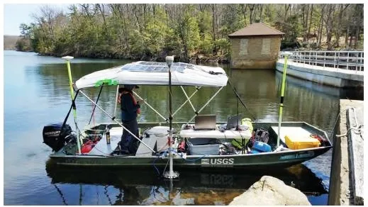
Full-swath multibeam coverage is often unnecessary — and disproportionately expensive — for a river cross-section, a small lake, or a reservoir volume study. Single-beam systems mounted on small manned boats or unmanned surface vehicles (USVs) remain the standard tool for exactly this kind of inland-water work, where a boat can log a continuous depth trace along planned transect lines fast enough to make full-coverage swath surveying unnecessary overhead.
Budget-conscious dredging and construction verification
Not every dredging or construction project can justify a full multibeam mobilization. For routine channel-depth checks and verifying that a dredge cut has reached design depth, a single-beam system run along planned lines is simple, robust, and dramatically cheaper to operate — and, as noted above, a dual-frequency unit can see straight through resuspended sediment to confirm the real bottom beneath it.
Quality-assurance cross-checks alongside multibeam
Single-beam echosounders also work as a companion instrument to multibeam rather than a replacement for it. In a 2017–2019 USGS bathymetric mapping program covering 17 reservoirs and lakes in New York City's East-of-Hudson water supply system, multibeam echosounders collected the primary depth data while single-beam soundings were logged separately as independent quality-assurance points — an efficient way to validate multibeam-derived surfaces without doubling the swath survey effort.
Calibration: The Bar Check
Where multibeam systems are calibrated through a four-variable patch test, single-beam systems are checked with a bar check: a flat plate is lowered beneath the transducer to a series of known depths, and the sound-velocity setting on the echosounder is adjusted until the instrument's measured depth matches the plate's actual depth at each step. Incorrect sound velocity is one of the largest sources of error in single-beam hydrographic survey work, so a bar check — paired with an independent sound-velocity cast of the water column — is standard practice before a survey begins, not an optional extra.
Standards: Where SBES Still Meets IHO S-44
The International Hydrographic Organization's S-44 standard defines the required bathymetric coverage by survey order, and the lower tiers were built with exactly this kind of line-based sounding in mind. Worked line-spacing examples in hydrographic engineering practice — for instance, an 8° beam-width single-beam system run at three times water depth for primary lines, with cross-check lines spaced ten times wider — arrive at bathymetric coverage on the order of 4–5%, which lines up closely with the coverage threshold S-44 sets for Order 2 and Order 1a surveys. That is a very different regime from the Special Order and newly introduced Exclusive Order categories, which now call for full, 100% seafloor ensonification and are effectively multibeam territory. A concrete real-world example of single-beam performance at this level comes from a USGS bathymetric survey of Walker Lake, Nevada, which used a Reson model 210 single-beam echosounder with a 2.7° beam width at 200 kHz, logging depths from 0.7 to 1,969 feet at a stated accuracy of 0.4 inches.
Conclusion
A century after Alexander Behm's post-Titanic experiments and the U.S. Coast and Geodetic Survey's first Hayes-equipped ships, the single-beam echosounder has not been made obsolete by its multibeam successor so much as it has settled into the jobs multibeam was never meant to do cheaply: a river cross-section, a reservoir volume check, a dredge-depth verification, or a quality-assurance line run alongside a full swath survey. Where a project genuinely needs total seafloor coverage, multibeam is the only real answer — but where it does not, single-beam remains the pragmatic, well-understood instrument surveyors reach for first.
References
- Dorokhov, D., Dudkov, I., Sivkov, V. (2019) — Single beam echo-sounding dataset and digital elevation model of the southeastern part of the Baltic Sea (Russian sector), Data in Brief
- Wikipedia — Alexander Behm; German Meteor Expedition
- NOAA Ocean Exploration — History Timeline: The Age of Electronics (1923–1945)
- Conrad Blucher Institute, Texas A&M University–Corpus Christi — Hydrographic Surveying: Single Beam Echo Sounder
- CEE HydroSystems — Single Beam Echo Sounders
- Tersus GNSS — What's Single-Beam Bathymetry?
- Orbital — Single Beam & Multi-Beam Echosounder for Bathymetry Survey
- International Hydrographic Organization — IHO Releases New Standards for Hydrographic Surveys (S-44 Edition 6)
- USGS — Bathymetry of Walker Lake, West-Central Nevada (Scientific Investigations Report 2007-5012)
- USGS — Geospatial Bathymetry Datasets for New York City's East of Hudson Reservoirs and Controlled Lakes; Echosounder and GPS Equipped Boat, Newton Reservoir