Geofisika & Geohazard
Synthetic Aperture Sonar: Why Resolution No Longer Has to Fade With Range
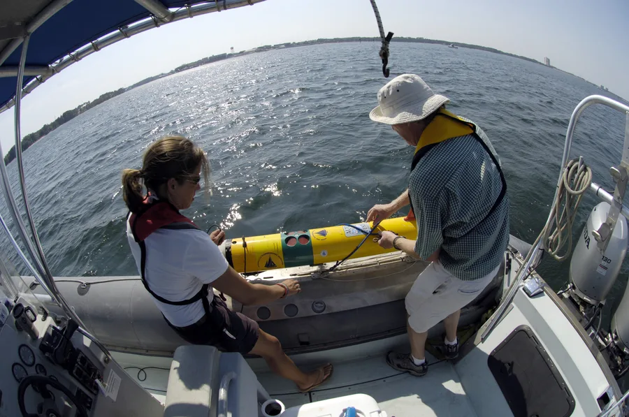
Every conventional side-scan sonar image carries the same built-in flaw: the farther a target sits from the towfish, the blurrier it gets. That trade-off has shaped survey planning for decades — tighter line spacing near the track, degraded detail at the swath edges. Synthetic aperture sonar (SAS) breaks that link entirely. By coherently combining dozens of successive pings into a single, much longer virtual receiving array, SAS delivers along-track resolution that stays essentially constant from near range to far range, turning a physics limitation that survey planners have always had to design around into a non-issue.
The Physics: Trading Time for Aperture
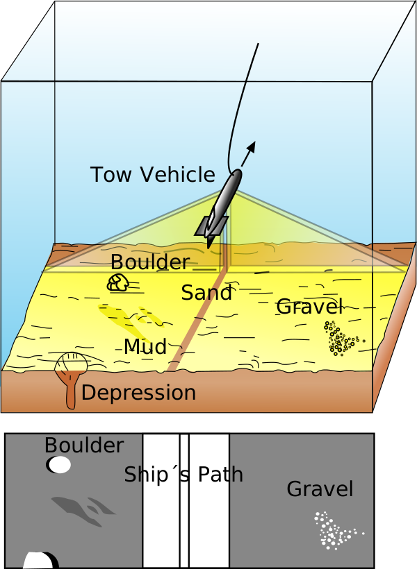
A conventional side-scan sonar's along-track resolution is set by its beamwidth: resolution equals range multiplied by the sine of the horizontal beamwidth angle, so as range grows, the footprint of a single beam on the seabed simply gets wider and detail is lost. The only way to hold resolution constant at longer range is to lengthen the physical transducer array — and there is a hard ceiling on how long an array can be before it stops fitting on a towfish or an AUV.
SAS sidesteps the ceiling by not trying to solve it with hardware at all. As the platform moves along its track, the same patch of seabed is illuminated by many successive pings. Because the system preserves the phase of each return rather than just its amplitude, those overlapping pings can be coherently reorganized into a single synthetic array many times longer than the physical one — a technique with the same mathematical basis as synthetic aperture radar (SAR), first developed for airborne imaging in the early 1950s. The achievable along-track resolution then approaches roughly half the physical length of one array element, bounded only by a quarter-wavelength lower limit, and critically, that resolution figure does not depend on range at all. A target at 250 metres resolves just as sharply as one at 25 metres, provided the processing conditions are met.
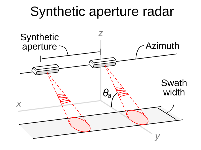
That coherence is expensive to buy. Nyquist sampling requires the receive array to advance no more than half its own physical length between pings, or grating lobes corrupt the image — which in practice caps survey speed relative to ping rate and range. The processing also demands precision "micronavigation": the system needs to know where each phase centre actually was in the water to a small fraction of a wavelength, far tighter than ordinary navigation accuracy, which is why SAS platforms lean on tightly integrated inertial navigation and Doppler velocity log data, plus autofocus algorithms that estimate and correct residual motion error directly from the acoustic data itself. Sound-speed variability in shallow, littoral water compounds the problem further, since it distorts the coherence the whole technique depends on.
From Airborne Radar to the Seabed: A Short History
The underlying idea traces to Carl Wiley at Goodyear Aircraft Company, who in 1951 recognized that Doppler shifts in a moving radar's returns could be used to synthesize a much longer antenna — the invention that became synthetic aperture radar. Adapting the concept to sound in water took decades longer, since underwater platforms move far more erratically than aircraft and water itself is a much less stable propagation medium than air. Most of the core underwater processing concepts were published and patented through the 1970s and 1980s, with the first successful physical experiments arriving in the early 1990s.
The step from laboratory demonstration to fielded system centred on Norway. Kongsberg's HUGIN autonomous underwater vehicle programme began in 1991, reaching its first commercial survey in 1997. In 2000, the Norwegian Defence Research Establishment (FFI) and Kongsberg Maritime launched a joint R&D effort to build a complete SAS system — hardware and processing software together — as a companion payload for HUGIN. That prototype, named SENSOTEK, went to sea on a HUGIN AUV in 2004. The result was two lasting products: Kongsberg's commercial HISAS sonar line and FFI's FOCUS processing toolbox, both still in active use two decades later.
What the Numbers Actually Look Like
The gap between SAS and conventional side-scan is not marginal. Kongsberg's HISAS 1030, fitted to HUGIN AUVs, is documented with a theoretical resolution of 2×2 cm and a practical resolution under 5×5 cm — held at every range out to its operating limit of roughly 200 to 260 metres per side, depending on vehicle speed. A conventional side-scan sonar built to match that same 2×2 cm resolution is, by comparison, limited to a maximum usable range of around 50 metres before the beamwidth geometry erodes it away. NOAA's own technology summary puts the practical gap even more bluntly: it describes SAS as capable of mapping a site at roughly 30 times the resolution of traditional side-scan sonar. Interferometric SAS variants add a further capability, deriving co-registered bathymetry — commonly cited around 25 cm horizontal resolution — from the same phase data used to form the backscatter image, alongside imagery resolution in the low single-digit centimetres.
None of this is free. NOAA notes plainly that SAS survey operations run at higher cost and lower area-coverage-rate efficiency than side-scan, and AUV-mounted systems in particular must hold survey speed down — often only a few knots — to satisfy the Nyquist sampling limit, which combines with battery endurance to cap how much seabed a single dive can cover. SAS is a tool for when resolution is the design driver, not when raw coverage speed is.
Application: Finding What Was Meant to Stay Hidden
Mine countermeasures and unexploded ordnance (UXO) detection remain the technology's primary driver, precisely because the targets are small, low-signature, and often deliberately difficult to distinguish from seabed clutter — exactly the regime where centimetre-scale, range-independent resolution earns its cost. NATO's Centre for Maritime Research and Experimentation (CMRE) has built its autonomous minehunting research programme, including the MUSCLE UUV, around high-frequency SAS specifically to push detection, classification, and identification of mine-like objects into real-time, GPU-accelerated onboard processing rather than requiring post-mission analysis ashore.
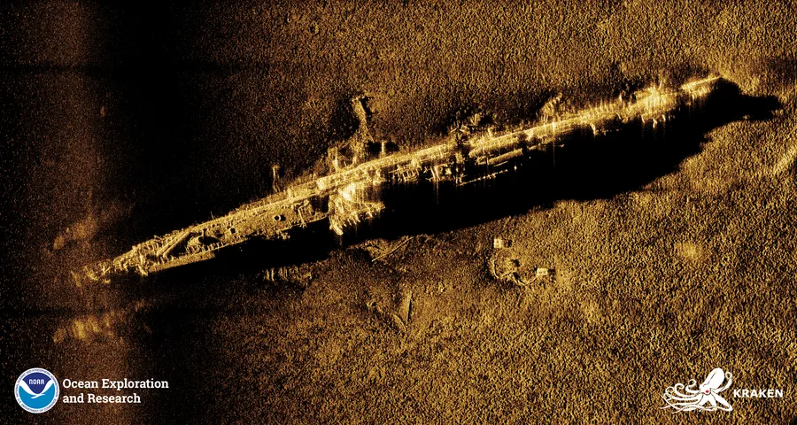
A concrete illustration of what SAS resolution unlocks at long range is the survey of the World War II chemical munitions dump site in the Skagerrak, off Norway's south coast, where roughly 168,000 tonnes of chemical weapons were scuttled aboard 38 ships in around 600 metres of water after the war. In 2015 and 2016, FFI deployed a HUGIN AUV carrying a HISAS interferometric SAS to search and document the site, mapping a roughly 450 km² area across 24 dives and 254 hours of survey time, and locating or relocating 35 shipwrecks. Follow-up dives in 2019 and 2022, using the same equipment, returned to individual wrecks to track structural decay over time — change-detection work that depends on the imagery being sharp and repeatable enough to compare year over year, not just adequate for a single detection pass.
Why AUVs and SAS Are a Natural Pair
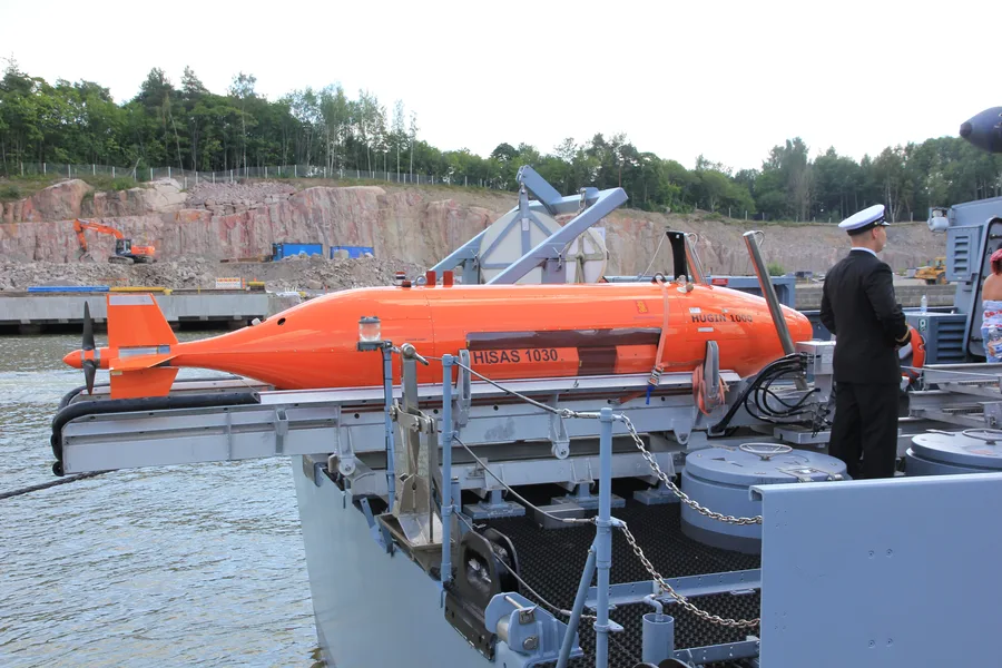
Range-independent resolution changes AUV survey planning in a way that matters beyond image quality. A side-scan sensor chasing a fixed resolution target has to keep survey lines closely spaced, because usable across-swath resolution collapses well before the nominal swath edge — meaning more lines, more turns, and more battery spent per square kilometre actually covered at full quality. A SAS payload holds that resolution all the way to its full swath width, so a single AUV pass can cover several hundred metres of seabed at the same detail level near and far from the track, reducing the number of lines needed to fully image a given area at a chosen resolution. That efficiency gain is precisely why manufacturers like Kongsberg built HISAS as an AUV payload from the outset rather than a hull-mounted or towed accessory: the vehicle's own straight-line, depth-stable transit is what lets the coherent processing work in the first place.
The trade-off is operational discipline. SAS demands more consistent vehicle speed and heading than side-scan tolerates, tighter integration with the AUV's inertial navigation and Doppler velocity log, and post-mission or onboard processing budgets that side-scan mosaicking never had to account for. For missions where the survey question is "how deep is the trench" or "where roughly is the pipeline," side-scan remains the faster, cheaper answer. For missions where the question is "is that object a mine, a rock, or debris" — or "has this wreck's hull condition changed since the last visit" — SAS is increasingly the only tool that answers with enough confidence to act on.
References
- "Synthetic-aperture sonar," Wikipedia, https://en.wikipedia.org/wiki/Synthetic-aperture_sonar
- "Synthetic Aperture Sonar Challenges," Hydro International, https://www.hydro-international.com/content/article/synthetic-aperture-sonar-challenges
- NOAA Ocean Exploration, "Synthetic Aperture Sonar (SAS)," https://oceanexplorer.noaa.gov/technology/sonar-sas/
- "High resolution interferometric synthetic aperture sonar HISAS 1030," Kongsberg Discovery, https://www.kongsberg.com/globalassets/kongsberg-discovery/naval/hisas/high-resolution-interferometric-synthetic-aperture-sonar---hisas-1030/
- "Interferometric Synthetic Aperture Sonar: A New Tool for Seafloor Characterization," Oceanography (TOS), https://tos.org/oceanography/article/interferometric-synthetic-aperture-sonar-a-new-tool-for-seafloor-characterization
- "History of SAR at Lockheed Martin (previously Goodyear Aerospace)," Lockheed Martin, https://www.lockheedmartin.com/en-us/news/features/history/sar.html
- "First field results for the HISAS Synthetic Aperture Sonar," Kongsberg Maritime, https://www.kongsberg.com/maritime/news-and-events/news-archive/2005/first-field-results-for-the-hisas-synthetic-aperture-sonar/
- NATO Centre for Maritime Research and Experimentation, "Research," NATO Science and Technology Organization, https://www.sto.nato.int/cmre/research-cmre/
- NVIDIA, "NATO CMRE Revolutionizes Real-Time Undersea Mine Detection," https://www.nvidia.com/content/tesla/pdf/nato-case-study.pdf
- Norwegian Defence Research Establishment (FFI), "Using an interferometric synthetic aperture sonar to inspect the Skagerrak World War II chemical munitions dump site," https://www.ffi.no/en/publications-archive/synthetic-aperture-sonar-images-and-bathymetries-from-the-2015-survey-of-the-skagerrak-world-war-ii-chemical-munitions-dump-site
Related Articles