Marine Survey Technology
Autonomous and Unmanned Survey Platforms: Taking the Crew Off the Boat
Every instrument a marine survey relies on still needs something to carry it across the water, and for most of the industry's history that something has meant a crewed vessel with people standing watch on deck. That assumption has been quietly coming apart for three decades, as autonomous underwater vehicles (AUVs) and uncrewed surface vessels (USVs) take over more of the work a survey used to require putting people at sea to do.
Two Different Kinds of Autonomy
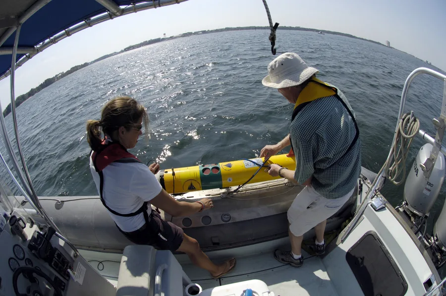
An AUV and a USV solve related but distinct problems. An AUV operates fully submerged and disconnected from GNSS signal for most of a mission, so it has to navigate primarily by dead reckoning and inertial sensors, surfacing or reporting to an acoustic positioning system only periodically to correct its accumulated drift. A USV, by contrast, stays on the surface for its entire mission, which means it keeps continuous access to GNSS positioning and, usually, a real-time or near-real-time communication link back to shore — a fundamentally easier navigation problem, even though the vessel itself still has to handle waves, weather, and collision avoidance without anyone aboard to react to them directly.
A Short History of Going Uncrewed
Woods Hole Oceanographic Institution's Oceanographic Systems Lab built its first REMUS (Remote Environmental Monitoring UnitS) AUV in 1995, designing it as a low-cost, torpedo-shaped platform simple enough to run from a laptop computer, originally intended for coastal monitoring work. The design proved capable enough that the U.S. Navy adopted it for mine countermeasures, and in 2003, during Operation Iraqi Freedom, REMUS vehicles were used to detect mines in the Persian Gulf harbor of Umm Qasr — clearing a hazardous area without divers or crewed vessels having to search it directly.
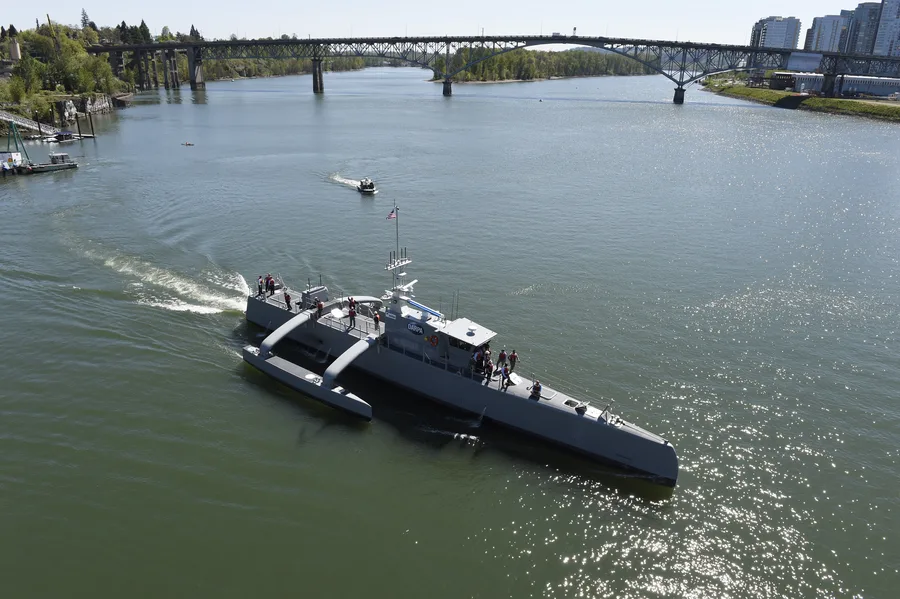
On the surface, Liquid Robotics' Wave Glider, a vehicle propelled by wave energy rather than a motor, set a very different kind of milestone. As part of the company's PacX mission, a Wave Glider named Papa Mau departed San Francisco Bay in 2011 and, after roughly eleven months at sea covering about 9,000 nautical miles and surviving mid-ocean storms along the way, reached Australia in November 2012 — becoming the first autonomous vehicle ever to cross the Pacific Ocean, while a sister vehicle set a Guinness World Record for longest journey by an autonomous surface vehicle. In 2016, the U.S. Navy launched Sea Hunter, an experimental trimaran-hulled USV built for long-endurance, crew-free anti-submarine warfare patrols, christened on the Willamette River in Portland, Oregon that April.
Uncrewed Platforms Doing Hydrographic Work Today
The clearest demonstration that uncrewed platforms can now do serious hydrographic work came from the Shell Ocean Discovery XPRIZE. In late 2018, the GEBCO-NF Alumni Team used SEA-KIT's USV Maxlimer as a remotely controlled mother ship to deploy a HUGIN AUV off Kalamata, Greece, mapping 278 square kilometers of Mediterranean seafloor in just 24 hours to win the competition outright. Maxlimer went on to rack up a string of further firsts: in May 2019, it completed what's described as the first commercial autonomous crossing of the North Sea, between England and Belgium; in July 2019, it deployed and recovered a HUGIN AUV for Equinor pipeline inspection work, the first time inspection equipment had been remotely controlled beyond line of sight; and in July 2020, it departed Plymouth on a 22-day uncrewed mission that mapped roughly 1,000 square kilometers of previously uncharted seafloor southwest of England — exactly the kind of large-scale bathymetric mapping that global efforts such as Seabed 2030 depend on.
The Real Trade-Offs
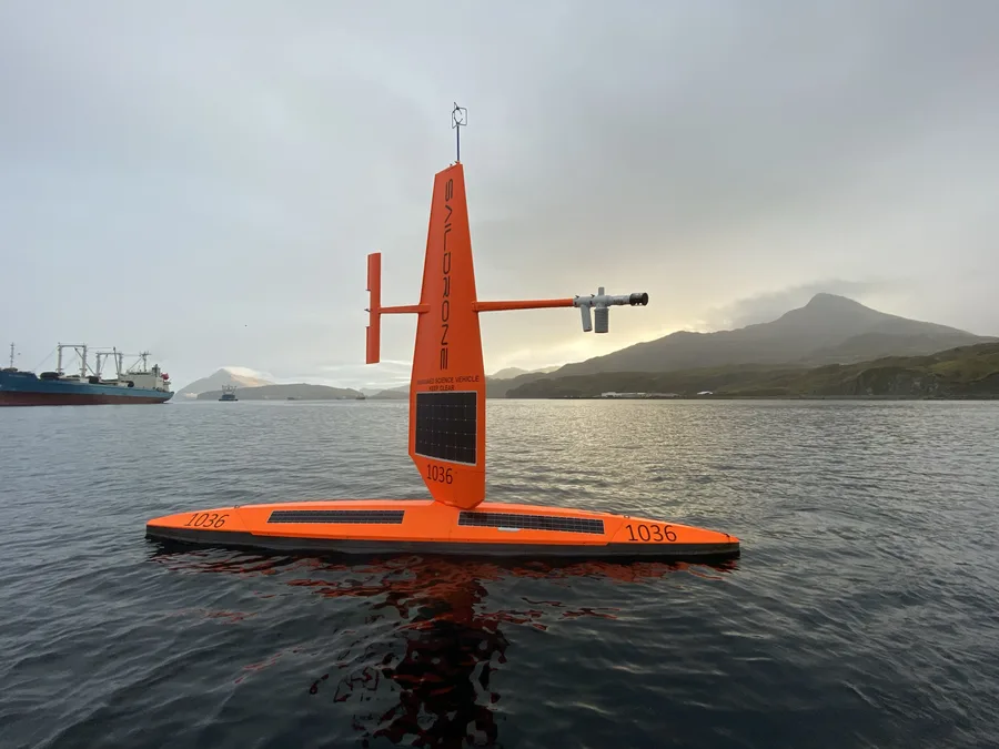
None of this makes crewed survey vessels obsolete. What an uncrewed platform gives up in exchange for lower operating cost, longer endurance, and zero personnel risk in hazardous work like mine clearance is real: a small AUV or USV carries a far more limited sensor payload than a proper survey ship, communication bandwidth back to shore is a genuine constraint rather than an afterthought, and there's no one on the scene able to exercise judgment when something unexpected happens that a pre-programmed mission plan didn't anticipate. The platforms that have proven themselves — REMUS in minefields, Maxlimer over unmapped seafloor — succeeded in roles where those trade-offs were clearly worth making, not because uncrewed operation is universally better than putting a crew on a boat.
Conclusion
From a torpedo-shaped robot built to run off a laptop in 1995 to a USV mapping a thousand square kilometers of unknown seafloor on its own over three weeks, the change in marine survey has never really been about the sensors — side-scan sonar, multibeam, magnetometers all work the same way whether a person or an algorithm is driving the boat. What's changed is the answer to a much older question: does getting this data actually require sending a person out to sea to collect it. Three decades of AUV and USV development have made the answer, for a growing share of survey work, simply no.
References
- Wikipedia — REMUS (vehicle); USV Maxlimer; Liquid Robotics
- Woods Hole Oceanographic Institution — REMUS
- Liquid Robotics — Liquid Robotics' Marine Robot Completes 9,000-Mile Cross-Pacific Journey
- IEEE Spectrum — Liquid Robotics' Wave Glider Completes Pacific Crossing
- Maritime Executive — SEA-KIT Gears Up for First Ever USV Transatlantic Crossing; Sea-Kit Completes Unmanned Survey Voyage in N. Atlantic
- Wikimedia Commons — REMUS Launch, AUV Fest 2007; Sea Hunter Christening, 2016; Saildrone, 2019 NOAA Arctic Mission
Related Articles
_during_Autonomous_Underwater_Vehicle_(AUV)_Fest_2007.jpg)
.jpg)
