Marine Survey Technology
Positioning Systems in Marine Survey: From GPS Satellites to Seafloor Transponders
Every marine survey instrument has one thing in common that rarely gets its own headline: a side-scan sonogram, a multibeam depth grid, a magnetometer anomaly — none of it means anything without knowing precisely where it was recorded. A perfect echosounder reading tied to the wrong coordinate is worse than no reading at all. Positioning is the layer that makes every other survey instrument trustworthy, and it turns out to be two almost entirely different engineering problems depending on whether the thing you're positioning is floating on the surface or sitting underwater.

Two Positioning Problems, One Job
On the surface, the problem is largely solved: a Global Navigation Satellite System (GNSS) receiver on a survey vessel can fix its position from satellite signals almost anywhere on Earth's oceans. Underwater, that same radio signal is useless — seawater absorbs it within a few meters. An ROV, AUV, diver, or seabed transponder has to be positioned some other way, and the only signal that reliably travels any distance through water is sound. That single physical constraint is why marine positioning splits into two largely separate toolkits rather than one: satellite-based systems above the surface, and acoustic ranging systems below it.
How Acoustic Positioning Works
Underwater acoustic positioning systems fall into three classes, distinguished by the spacing between their reference transducers. Long baseline (LBL) systems rely on three or more transponder beacons fixed to the seafloor at precisely known coordinates; an interrogator on the tracked object ranges to each beacon, and the intersection of those ranges solves the position. Because the reference transponders sit in the same frame as the work site and avoid long acoustic paths to a distant, rolling sea surface, LBL is the most accurate of the three — generally better than 1 meter, and in favorable short-range setups as fine as a centimeter. Short baseline (SBL) systems use the same triangulation principle but with three or more transducers wired to a single control box (often hull-mounted), trading some accuracy for the convenience of not needing a seafloor array. Ultra-short baseline (USBL) systems go further still: a single, compact transducer array — commonly around 10 cm across — measures both the range and the phase-shift angle to a subsea transponder from one mounting point, usually a pole under the survey vessel. USBL is by far the quickest to mobilize, which is why it's the default choice for tracking ROVs, AUVs, and divers during routine survey and inspection work — but the price is that its fixed angular resolution translates into a larger absolute position error the farther the target is from the vessel.
From Doppler Submarines to Centimeter-Level Surveys
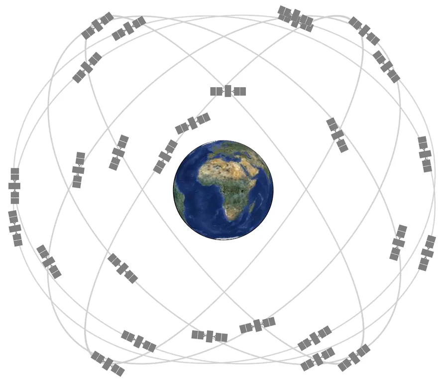
Satellite positioning traces back to 1957, when American scientists tracking Sputnik's radio signal noticed its frequency shifted predictably as the satellite approached and receded — the Doppler effect. The U.S. Navy turned that observation into Transit, the first satellite navigation system, developed specifically to update the inertial guidance of Polaris ballistic-missile submarines between dives. Transit 1B reached orbit on April 13, 1960; the system entered naval service in 1964 and reached a full 36-satellite constellation by 1968, though it could only deliver a position fix roughly once an hour. GPS superseded it with continuous, real-time coverage: the first Block-I satellite, Navstar 1, launched on February 22, 1978, the system reached a full 24-satellite constellation by December 1993, and Full Operational Capability was declared on April 27, 1995. A deliberate signal-degradation feature called Selective Availability — which had capped civilian accuracy at roughly 100 meters — was switched off by presidential order on May 1, 2000, immediately improving civilian GPS accuracy by an order of magnitude overnight. Transit itself was retired in 1996, its job fully absorbed by the system it had inspired.
The underwater side of the story starts, somewhat grimly, with a submarine disaster. When USS Thresher was lost on April 10, 1963, at a depth of 2,560 meters, the oceanographic vessel USNS Mizar was fitted with a short baseline acoustic system to guide the bathyscaphe Trieste to the wreck site — one of the earliest documented operational uses of underwater acoustic positioning. The technology was still immature: out of ten search dives, the crew achieved visual contact with the wreckage only once. It matured quickly after that. Acoustic positioning helped locate a nuclear bomb lost off Spain's coast after a 1966 B-52 crash near Palomares, and through the 1970s, offshore oil and gas exploration in ever-deeper water demanded better underwater positioning to place drill strings and construction equipment exactly where seismic surveys said they should go. Commercial USBL systems, including early Sonardyne products, arrived in the late 1980s and early 1990s, and by 1998 advanced LBL positioning was precise enough to guide the search for the Japanese submarine I-52 at 5,240 meters depth.
Modern Precision: RTK, PPP, and GNSS/INS
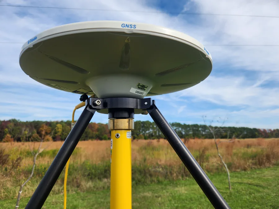
Raw GNSS alone is good for a few meters of accuracy — nowhere near good enough for hydrographic work. Real-Time Kinematic (RTK) correction, which compares a vessel's GNSS signal against a nearby fixed reference station, closes that gap dramatically: single-baseline RTK-derived coordinates have been shown to agree with relative solutions to within 7 cm or better. The U.S. Army Corps of Engineers adopted the technology early — surveyor Brian Shannon built the first permanent RTK network for the Corps' Jacksonville District in 1997, using it to position vessels horizontally and measure water-surface elevation at the Kings Bay entrance channel, and by 1998 nearly the entire Corps survey fleet had switched over. Where a fixed reference station isn't practical, Precise Point Positioning (PPP) offers an alternative: it delivers high-precision fixes from a single receiver using precise satellite orbit and clock corrections instead of a local base station, at the cost of a longer convergence time. Real-time PPP fed by the International GNSS Service has been used to derive continuous, centimeter-precision tide and water-level data directly from floating GNSS buoys — an approach that is steadily displacing traditional tide-gauge infrastructure in offshore surveys, since the ellipsoidal height a GNSS receiver reports can be tied directly into a vertical datum without a shore-based gauge at all.
The more recent refinement is tighter integration between GNSS and inertial navigation systems (INS), which fill in position and attitude during the brief signal dropouts a survey vessel inevitably experiences. A 2024 study in the journal Sensors tested an Ellipse-D GNSS/INS unit aboard an unmanned surface vessel called HydroDron on Lake Kłodno, Poland, running four separate survey patterns over roughly 13,665 logged data points. Even with mobile-network coverage gaps that pushed 30–40% of the readings into differential mode rather than full RTK, the system held 2D horizontal accuracy (R95) between 0.877 and 0.941 meters, with pitch and roll error around 0.06° in RTK mode and roughly 0.2° in differential mode — comfortably meeting IHO survey-order requirements across the board, from Exclusive Order down to Order 2. That same GNSS/INS pairing is what ultimately feeds the heave, pitch, roll, and heading corrections a multibeam echosounder needs during its own patch-test calibration — positioning and bathymetry aren't really two separate disciplines in practice, they're one continuous measurement chain.
Where Positioning Meets Survey Instruments
Every acoustic survey instrument leans on one of these positioning layers to be useful at all. A side-scan sonogram or sub-bottom profile is only as trustworthy as the GNSS/INS solution that geo-referenced the towfish behind the vessel. A multibeam echosounder's patch test exists specifically to reconcile the sonar's beams with the vessel's GNSS-and-INS-derived attitude. Subsea positioning does the equivalent job for anything that leaves the vessel entirely: USBL is the standard way to track an ROV or diver relocating a magnetic anomaly flagged during a UXO survey, and LBL comes into play wherever an AUV or ROV needs centimeter-level position over an extended pipeline or cable inspection run, independent of range from the support vessel. Offshore construction vessels performing dynamic positioning — holding station over a wellhead or a wind-turbine foundation location during installation — depend on exactly the same RTK/GNSS and acoustic reference inputs described above, just wired into a control loop instead of a survey log.
Standards: Positioning Inside IHO S-44
The IHO S-44 standard, widely used for its bathymetric coverage and depth-accuracy requirements, treats positioning with equal seriousness through a metric called Total Horizontal Uncertainty (THU) — a single, two-dimensional value expressed at a 95% confidence level that folds in every contributing source of horizontal error. Critically, S-44 requires that when auxiliary equipment is used to determine or improve a survey platform's position — a GNSS receiver, an RTK correction service, an INS — the residual uncertainty of that equipment itself has to be included in the THU calculation, not assumed away. A survey isn't compliant with a given IHO order just because its echosounder is accurate; the positioning chain that geo-references every sounding has to meet the same bar.
Conclusion
From a Cold War satellite tracking exercise and a submarine disaster's search effort to centimeter-level RTK networks and GNSS buoys that have made shore-based tide gauges optional, positioning technology has quietly become the layer every other marine survey instrument depends on without saying so out loud. A side-scan image, a bathymetric surface, a magnetic anomaly, a geohazard map — none of it is more trustworthy than the position fix underneath it. Getting that layer right, on the surface and underwater alike, isn't a footnote to a survey. It's the part that makes every other survey result actually mean something.
References
- Specht, M. (2024) — Testing and Analysis of Selected Navigation Parameters of the GNSS/INS System for USV Path Localization during Inland Hydrographic Surveys, Sensors, Vol. 24, No. 8, Article 2418
- Sensors (2020) — Evaluation of Real-Time PPP-Based Tide Measurement Using IGS Real-Time Service, Sensors, Vol. 20, No. 10, Article 2968
- Journal of Geodesy (2025) — Depth Modernization by Integrating Mean Sea Surface Model, Ocean Tide Model, and Precise Ship Positioning
- Scientific Reports (2024) — Comparison of the Vertical Accuracy of Satellite-Based Correction Service and the PPK GNSS Method for Obtaining Sensor Positions on a Multibeam Bathymetric Survey
- Wikipedia — Underwater Acoustic Positioning System; Transit (satellite); Global Positioning System; Trieste (bathyscaphe); USS Thresher (SSN-593)
- The American Surveyor — History of RTK, Part 4: Birth of a Utility
- GPS.gov — GPS Image Library
- USGS — GNSS Receiver for Monitoring Land Motion
- International Hydrographic Organization — S-44 Standards for Hydrographic Surveys
Related Articles