Marine Survey Technology
Airborne Lidar Bathymetry vs. Acoustic Echosounders: Choosing the Right Way to Measure Depth
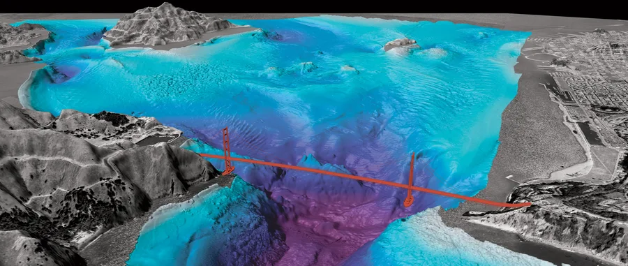
In 1975, Australia's Royal Australian Navy Hydrographic Service was facing a problem no ship could realistically solve: at the pace a ship-borne echosounder could cover the country's continental shelf, a full survey was projected to take about 80 years. The answer wasn't a faster boat — it was to stop putting the sounder in the water at all and put it on an aircraft instead, firing a laser down through the water column rather than sound through it. Half a century later, airborne lidar bathymetry (ALB) and acoustic echosounders both still do the job of measuring depth, but they solve fundamentally different problems, and knowing which one actually fits a given survey matters more than treating one as a simple upgrade of the other.
Why Australia Built a Laser Sounder in 1975
The case for airborne bathymetry wasn't theoretical curiosity — it was a hydrographic backlog with a very concrete number attached. Confronted with an estimate that surveying Australia's entire continental shelf by ship would take roughly 80 years, the Royal Australian Navy asked the Weapons Research Establishment's Electronic Research Laboratory to find a faster way. Under Mike Penny's leadership, an experimental system called WRELADS I was built and installed in a Beechcraft Queenair, flying 148 hours of test flights in 1976 and 1977. It worked well enough to justify a second-generation WRELADS II, which eventually matured into the operational Laser Airborne Depth Sounder (LADS) for the Royal Australian Navy. Australia wasn't alone in the effort — the early 1980s also saw the U.S. Airborne Oceanographic Lidar (AOL), a joint project between NASA, NOAA, the U.S. Navy, and AVCO, and the Hydrographic Airborne Laser Sounder (HALS) — but the Australian program is generally credited as the one that proved a laser sounder could do real hydrographic work rather than just a laboratory demonstration.
How a Laser Measures Depth
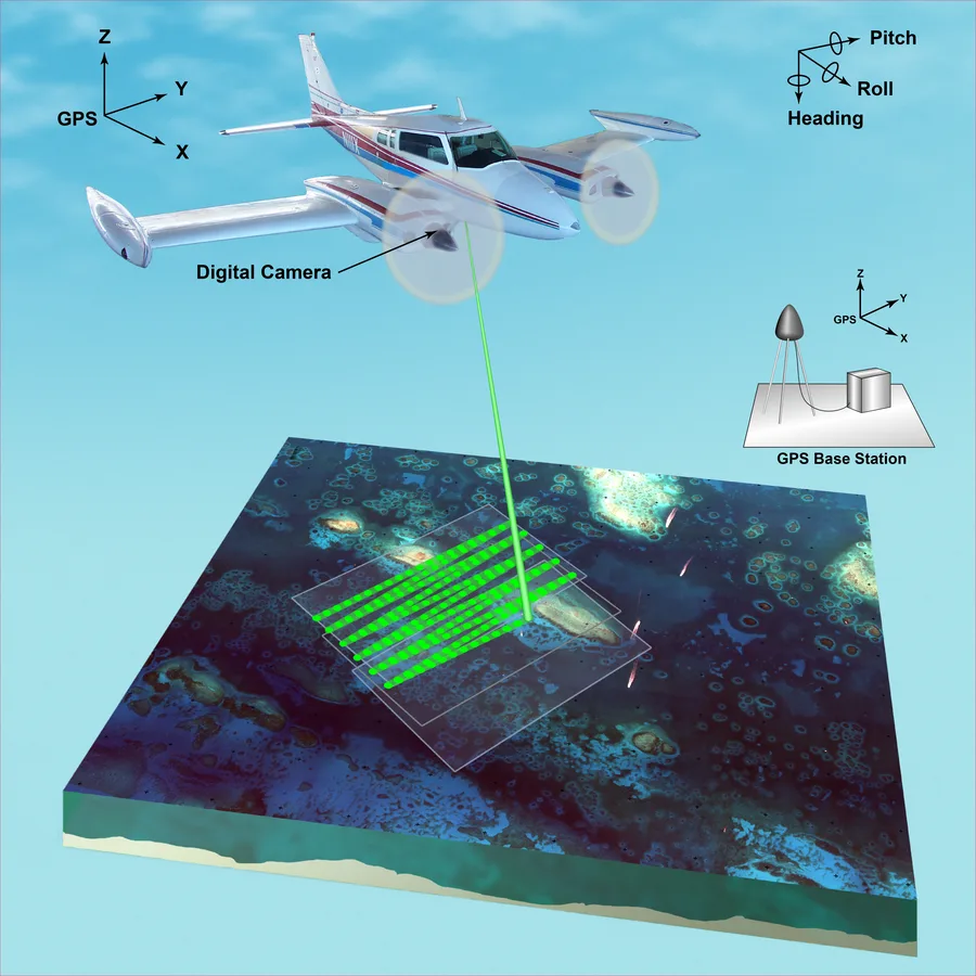
An airborne lidar bathymetry system fires a pulsed laser toward the water from an aircraft and measures the time it takes for the reflected light to return. Modern systems use a green laser at roughly 532 nanometers, a wavelength chosen specifically because it experiences comparatively little absorption or scattering in clear water, unlike the near-infrared lasers used for pure topographic (land) lidar. Part of the pulse reflects off the water's surface, and part continues down and reflects off the seabed; the difference between the two return times, corrected for the speed of light in water, gives the depth. Because the system can also record the water-surface and land-surface returns from the same pass, it produces a single, seamless elevation model that spans dry land straight through to the submerged seabed — something no ship-based method can do on its own, since a vessel simply can't sail onto the beach.
Where the Laser Runs Out: Turbidity and Depth
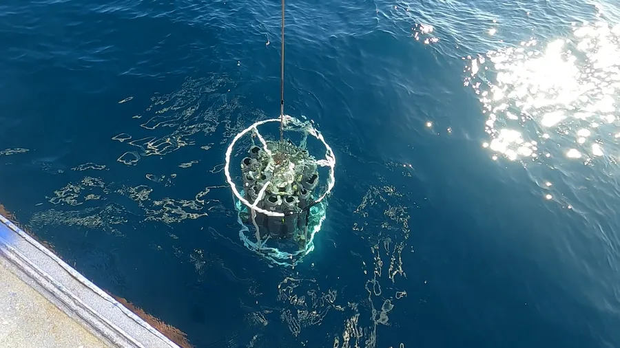
The single biggest limitation on ALB is water clarity, not equipment. Suspended sediment, algae, and other particles scatter and absorb the laser pulse, and the depth a system can effectively reach is tied to the Secchi depth — a simple field measure of water clarity — with well-designed systems reaching roughly one to three times that Secchi depth in good conditions. In very clear water, green laser light can penetrate on the order of 50 meters; in turbid coastal water common in much of the tropics, effective depth can be far shallower than that. An acoustic echosounder has essentially the opposite profile: it isn't limited by water clarity at all, since it depends on sound rather than light, and can sound to full ocean depths regardless of how murky the water is. What it can't do is work outside the water — a multibeam echosounder needs a hull in the water above whatever it's measuring, which is exactly the constraint ALB was invented to escape.
Coverage and Efficiency in Shallow Water
Beyond depth penetration, the two methods differ in how their coverage scales with water depth. A multibeam echosounder's swath width is a function of water depth and the sonar's beam angle — in very shallow water, the usable swath narrows, so the vessel has to run more closely spaced lines to achieve full coverage, and a survey vessel's draft may prevent it from safely entering shallow water at all. An airborne lidar system's swath, by contrast, is set by flight altitude and scan angle, entirely independent of water depth, so it keeps flying efficient, wide, evenly spaced lines whether it's mapping a 2-meter reef flat or a 20-meter channel. That's the core reason ALB has become the tool of choice for nearshore, reef, and very shallow coastal mapping, where a survey vessel is slow, restricted, or simply can't safely go, while acoustic systems remain the only practical option once water clarity or depth takes the laser out of the picture entirely.
Modern Systems and What They're Used For
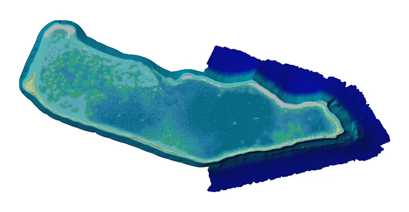
Today's topo-bathymetric lidar systems — the RIEGL VQ-880-G, Leica Chiroptera and HawkEye, and Teledyne Optech's CZMIL family among them — are built specifically to collect topographic and bathymetric data in the same mission, some reaching a stated vertical accuracy at the decimeter level, well within what the IHO's Special Publication 44 requires for many orders of hydrographic survey. The Leica Chiroptera 4X, for example, captures around 140,000 points per second and covers shallow water down to about 25 meters in favorable conditions. These systems have been evaluated directly against ship-based multibeam sonar for tasks like coral reef ecosystem mapping, and used for exactly the seamless coastal elevation modeling shown in the Majuro Atoll example above — work that matters for storm surge and flood modeling, coastal erosion monitoring, and habitat mapping in areas a survey vessel would struggle to reach efficiently. For hard-to-chart shallow and remote coastal zones — precisely the kind of gap global mapping efforts like Seabed 2030 are trying to close — airborne lidar and acoustic echosounders increasingly function less as competitors and more as two halves of the same coastal mapping toolkit, each covering the terrain the other one can't.
Conclusion
Neither method has made the other obsolete, and that was never really the point of building a laser sounder in the first place — WRELADS was invented to survey shelf areas a ship-bound schedule couldn't reach in a reasonable timeframe, not to replace the echosounder. Fifty years on, that division of labor still holds: airborne lidar bathymetry earns its place in shallow, clear, hard-to-reach coastal water where a vessel is inefficient or can't go at all, while acoustic echosounders remain the only method that works regardless of depth or water clarity once a survey moves offshore. Choosing between them is less a question of which technology is more advanced, and more a question of which one actually matches the water in front of you.
References
- Defence Science and Technology Group, Australia — Laser Airborne Depth Sounder (LADS)
- International Hydrographic Review (IHR) — Airborne Lidar Bathymetry
- Hydro International — Charting Depths From Above With Airborne Bathymetric Lidar
- Hydro International — State of the Art in Multibeam Echosounders
- Leica Geosystems — Mapping Underwater Terrain With Bathymetric Lidar
- IEEE Xplore — Results From 3 Seasons of Surveys in Maritime Canada Using the Leica Chiroptera II Shallow Water Topo-Bathymetric Lidar Sensor
- ResearchGate — Comparative Evaluation of Airborne LiDAR and Ship-Based Multibeam Sonar Bathymetry and Intensity for Mapping Coral Reef Ecosystems
- PMC / National Library of Medicine — Evaluation of a New Lightweight UAV-Borne Topo-Bathymetric LiDAR for Shallow Water Bathymetry and Object Detection
Related Articles