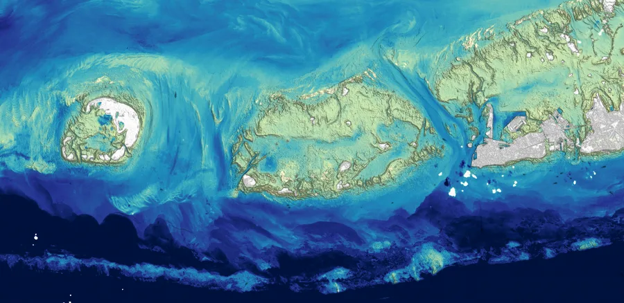
Hidrografi
Choosing Between MBES, Airborne Lidar, and Satellite Imagery for Coastal Mapping
A coastal engineering firm needs bathymetric data for a 40-kilometre stretch of shoreline. They have three genuinely viable tools available — a multibeam echosounder on a survey vessel, an airborne lidar system, and satellite-derived bathymetry from existing imagery — and each one has already been covered on its own in detail elsewhere. What's missing from a technology-by-technology explanation is the part a project manager actually needs: given a real depth range, a real budget, a real deadline, and water that isn't always perfectly clear, which one do you actually pick?
The Three Tools, in Brief
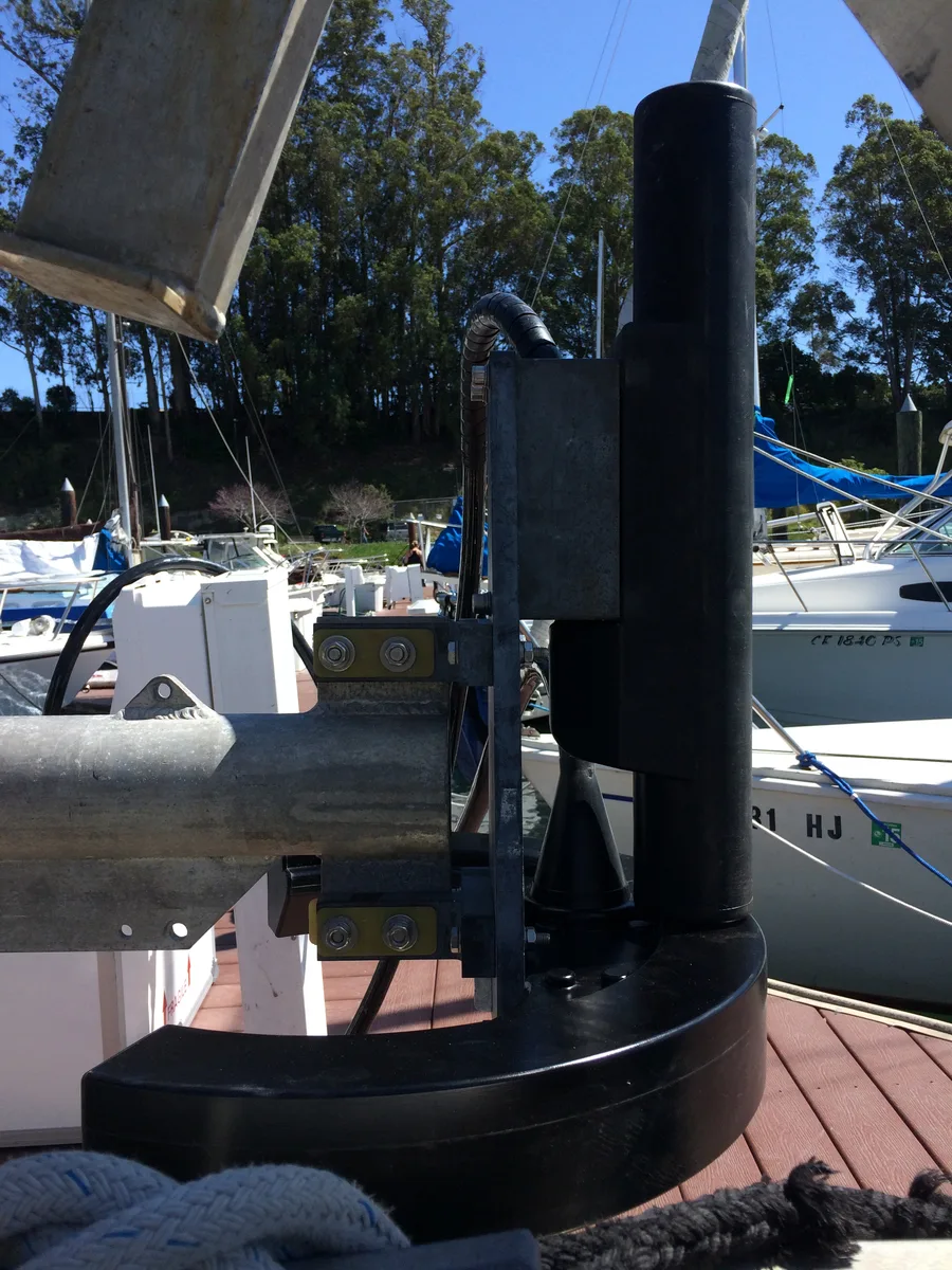
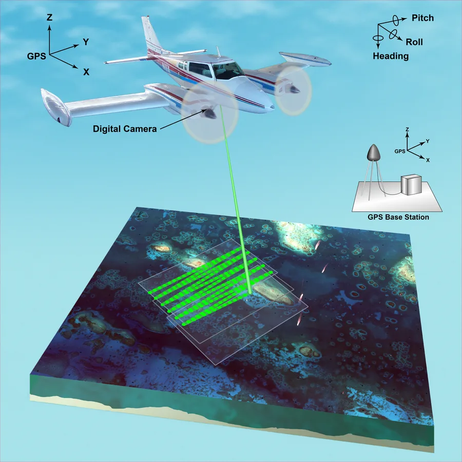
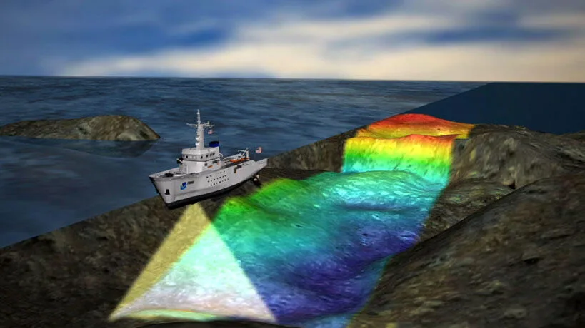
A multibeam echosounder (MBES), mounted on a survey vessel, fires a fan of acoustic pulses across the seabed and times their return to build a dense, centimetre-accurate depth model. It is the instrument of record for anything requiring survey-grade compliance — port approaches, dredging volumes, chart production under IHO S-44. Airborne lidar bathymetry fires a green laser (532 nm) from an aircraft, which penetrates clear water and reflects off the seabed, letting a single flight line sweep a wide swath at aircraft speed rather than vessel speed. Satellite-derived bathymetry (SDB) takes the opposite approach entirely: instead of sending anything down to the seabed, it infers depth from how much of the sun's light — already reflected off the bottom and back up through the water column — survives to reach a satellite sensor, using existing multispectral imagery that may already have been captured for another purpose entirely.
None of these three is a strictly better version of the other two. Each trades away something the others are good at, and the trade generally comes down to four practical variables: how deep the water actually is, how clear it is, how much budget and mobilization time is available, and how accurate the final product needs to be.
Depth Range: Where Each Method Actually Works
Modern high-frequency multibeam systems can technically operate in water as shallow as 1 to 3 metres below the transducer, and reach several hundred metres or more with a mid-frequency system, up to full ocean depth with deep-water systems. The real limiting factor in shallow water is rarely the acoustics — it's whether a survey vessel can physically get into water that shallow at all, which is why very shallow nearshore zones are often the weakest-covered part of an otherwise excellent MBES dataset.
Airborne lidar bathymetry is built for exactly that gap. In clear water, a bathymetric lidar system can detect depths down to roughly 60 metres, and because the aircraft never has to touch the water, it can survey right up to the shoreline and across very shallow reefs, sandbars, and lagoons that a vessel-mounted MBES would need a much smaller, slower boat to approach safely.
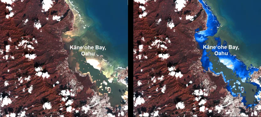
Satellite-derived bathymetry sits at the shallow, wide-area end of the range. Techniques based on the radiative transfer of light through water are most accurate in water up to about 15 metres deep, with absolute error typically running 10-20% of the depth value and an average RMSE around 1.5 metres in favourable conditions — coarser than either MBES or lidar, but achieved with zero vessel time and, if suitable archival imagery already exists, potentially zero new data collection at all.
Water Clarity: The Variable That Rules Out Two of the Three
MBES is acoustic, not optical, so turbidity is essentially irrelevant to it — a muddy river mouth and a gin-clear reef lagoon are the same problem to a transducer as long as the water is deep enough to reach. Lidar and satellite-derived bathymetry are both fundamentally optical methods, and both fail in the same way when water clarity drops: the light simply doesn't make it to the seabed and back before it's scattered or absorbed. In a turbid estuary or a sediment-laden coastal plume, the 60-metre lidar figure and the 15-metre SDB figure can both collapse to a fraction of their clear-water potential, sometimes to just a metre or two. This is the single most common reason a project that looks like an obvious lidar or SDB candidate on a map ends up needing MBES instead — not because the water is too deep, but because it's too murky.
Budget, Mobilization, and Timeline
MBES is the most expensive of the three by a wide margin once mobilization is counted: a survey vessel, an experienced hydrographic crew, fuel, and days or weeks on site, all before a single sounding is processed. Airborne lidar avoids the vessel entirely — an aircraft can cover a wide swath at flight speed, which for coastal and reef mapping is typically faster and cheaper per square kilometre than a vessel-based survey, though the aircraft, sensor, and flight crew are still a real mobilization cost. Satellite-derived bathymetry is the cheapest option by a large margin whenever existing imagery already covers the area of interest, since no new data collection may be required at all — the cost is almost entirely in the processing and validation, not the acquisition.
Timeline follows the same pattern. A satellite tasking request or an archival imagery search can turn around a first-pass bathymetric estimate in days. An airborne lidar campaign depends on aircraft availability and flying weather, but a wide coastal strip can typically be flown in a handful of sorties. A vessel-based MBES survey of the same 40-kilometre stretch, run at survey speed with the line spacing needed for full seafloor coverage, is realistically a multi-week undertaking once mobilization, weather days, and line-turns are factored in.
A Real Comparison: Kaeyado Island, South Korea
A 2018 study of the nearshore coastline near Kaeyado Island, western Korea, ran exactly this three-way comparison directly against each other over the same stretch of seabed, in water less than 30 metres deep. Researchers used a shipborne Seabat 7125 multibeam system (400 kHz), a CZMIL airborne bathymetric lidar system using dual laser wavelengths (1064 nm and 532 nm), and satellite altimetry-derived gravity anomalies processed through the Gravity-Geologic Method. Using satellite gravity data alone, checked against multibeam soundings, produced a root-mean-square error (RMSE) of 0.19 metres against the multibeam data itself, but 1.13 metres when checked against the lidar dataset — a real, measurable gap between methods surveying the same seafloor. When the researchers combined all three datasets into an improved model, the RMSE against lidar dropped to 0.24 metres, a 78% improvement, with the combined approach reaching roughly 0.2 metres of accuracy overall.
The lesson from a study like this isn't that one of the three methods "wins." It's that each one, used alone, carries a specific, measurable error signature relative to the others — and that combining datasets, rather than picking a single winner, often outperforms any one method on its own.
A Practical Decision Framework
Reduced to a working rule of thumb: if the project requires survey-grade, contractually defensible accuracy — dredging volumes, port approaches, chart production — MBES is not optional, regardless of cost, because it is the only method built to meet formal hydrographic standards. If the area is shallow, the water is reasonably clear, and speed over a wide coastal strip matters more than centimetre-level certification, airborne lidar is usually the better economic choice. If the project is early-stage reconnaissance, a very large or remote area, or a tight budget with no requirement for certified accuracy, satellite-derived bathymetry can produce a usable first-pass model, often from imagery that already exists, before any field mobilization happens at all.
In practice, many real projects don't stop at picking one. A common pattern is to use SDB or lidar to plan and prioritize where a more expensive MBES survey is actually needed, or to fill in shallow nearshore gaps that a vessel-based survey structurally can't reach — treating the three methods as complementary layers of the same mapping problem rather than three competing bids for the same job.
The Right Tool Depends on the Question, Not the Technology
None of the three methods described here is obsolete, and none is universally superior — a fact the Kaeyado Island study demonstrates with actual numbers rather than marketing claims. The real decision a project manager is making isn't "which bathymetry technology is best," but "what does this specific project actually require": a depth range, a water clarity condition, a budget, a timeline, and an accuracy standard. Answer those four questions honestly, and the choice between MBES, airborne lidar, and satellite-derived bathymetry mostly makes itself.
References
- Evaluation of the Accuracy of Bathymetry on the Nearshore Coastlines of Western Korea from Satellite Altimetry, Multi-Beam, and Airborne Bathymetric LiDAR, PMC, https://pmc.ncbi.nlm.nih.gov/articles/PMC6164467/
- Comparative Evaluation of Airborne LiDAR and Ship-Based Multibeam Sonar Bathymetry and Intensity for Mapping Coral Reef Ecosystems, ScienceDirect, https://www.sciencedirect.com/science/article/abs/pii/S0034425709000236
- Satellite Computed Bathymetry Assessment — Developing Satellite LiDAR Methods to Enhance Coastal Bathymetry Coverage, International Hydrographic Review (IHR), https://ihr.iho.int/articles/satellite-computed-bathymetry-assessment-developing-satellite-lidar-methods-to-enhance-coastal-bathymetry-coverage/
- Selecting the Best Habitat Mapping Technique: A Comparative Assessment for Fisheries Management in Exmouth Gulf, Frontiers in Marine Science, https://www.frontiersin.org/journals/marine-science/articles/10.3389/fmars.2025.1570277/full
- Kongsberg, "Discovering the Redefined EM Multibeam Echo Sounder Series," https://www.kongsberg.com/contentassets/71ac3f7f94c84db383e3dc1819ec5677/discovering-the-redefined-em-series-2022.pdf
- Coastal Wiki, "Satellite-Derived Nearshore Bathymetry," https://www.coastalwiki.org/wiki/Satellite-derived_nearshore_bathymetry
- NOAA, "What Is Lidar?," https://oceanservice.noaa.gov/facts/lidar.html
Related Articles
Applications of Multibeam Echosounders: From Single Soundings to Full 3D Seafloor Maps
Airborne Lidar Bathymetry vs. Acoustic Echosounders: Choosing the Right Way to Measure Depth