Platforms & Survey Operations
Hydrographic Survey Cost Explained for First-Time Buyers
Hydrographic survey cost is easier to judge once you know what sits inside the quote. Most of the price is vessel time, people, equipment, travel to site and data processing. This article explains each part, shows what pushes prices up or down, and helps you compare lump sum and day rate offers fairly.
What makes up hydrographic survey cost
A survey quote is mostly a quote for time. Rob Berlijn, writing in Hydro International in 2007, names time, field work and data processing as the main cost drivers of a ship-based survey. He also calls the vessel the major cost component of a bathymetric survey, meaning a survey that maps water depth. This is one author's view, not a data study. Trained people and reliable instruments can be bought at fair prices, but the vessel usually stays the largest line.
Most quotes break down into the same parts. Mobilization and demobilization cover moving the vessel, equipment and crew to site and back. Vessel days cover the ship and its crew while it works. Equipment and personnel are listed next. Then come data processing and reporting. Weather standby covers days lost when wind or waves stop work. Ask the contractor to show each part as its own line.
How a day rate is built
The Woods Hole Oceanographic Institution shows how a day rate can work for a research ship. It is not a commercial survey vessel, so treat it as an illustration only. The ship is charged for every operating day, which is a day away from its home port and available for work. Mobilization and demobilization days count. Time lost to weather at sea can be charged until the ship returns to port. The daily rate is the ship's yearly operating cost divided by its available operating days.
Moving a vessel to site is its own topic. Our guide to offshore survey vessel mobilization logistics covers it in detail.
Processing time is easy to forget
Field days are only half the work. The US Bureau of Reclamation, in a 2023 reservoir study, uses a conservative estimate of two processing days for each day of multibeam data. Multibeam is a sonar that measures a wide strip of seabed with each pass. Processing can take longer over soft bottoms or very muddy water. Single-beam and ADCP data need about one processing day per field day. Check that your quote includes processing and reporting time.
What pushes the price up or down
NOAA's 2005 cost comparison names location, depth, seabed complexity and method as the main drivers. Alaska costs far more because it is far from fuel and supplies, and the weather is harsh. Shallow water is slower and dearer for multibeam and side scan sonar, because survey lines must sit closer together to cover the whole seabed. A flat seabed is faster to survey than a rough one. The Bureau of Reclamation adds that water surface area, depth and the type of sounding tool matter most for reservoirs.
Job size matters too. The US Army Corps of Engineers manual (2002 edition) states that small survey projects always cost more per unit than large ones. Mobilization and general overhead are spread over less work. The same manual suggests combining nearby jobs into one order. It also warns about over-capability. Sending a multibeam vessel with a five-person crew to survey one beach profile is wasteful when a two-person topographic team can do it.
An old example of the size of the effect
A 2001 study by KPMG for NOAA gives cost per square nautical mile for contractors, in fiscal year 2001 US dollars. These are old US government figures. They are not today's prices and they do not apply to Indonesia. They only show the ratio between a remote, shallow site and an easy one.
| Contractor survey area (2001 study) | Cost per square nautical mile (FY2001 US$) |
|---|---|
| Alaska, shallow water | about 58,380 |
| Alaska, deep water (over 30 m) | about 35,620 |
| Gulf of Mexico | about 19,700 |
Shallow Alaska cost about three times the Gulf of Mexico. KPMG gave possible reasons. Suitable vessels were scarce and competed with the fishing industry. The survey season was short. Mobilization was expensive because of distance, and few surveys shared that cost. KPMG could not check contract details because of confidentiality, so these are explanations, not audit findings.
How the IHO S-44 order changes the bill
IHO S-44 is the international standard for survey accuracy. Edition 6.0.0 (2020) defines orders, and each order sets minimum accuracy and seabed coverage. Order 2 and Order 1b require 5% bathymetric coverage. Order 1a and Special Order require 100%. Exclusive Order requires 200%. S-44 does not mention cost. The link is simple, though. Full or double coverage needs closer or overlapping lines, which means more vessel time.
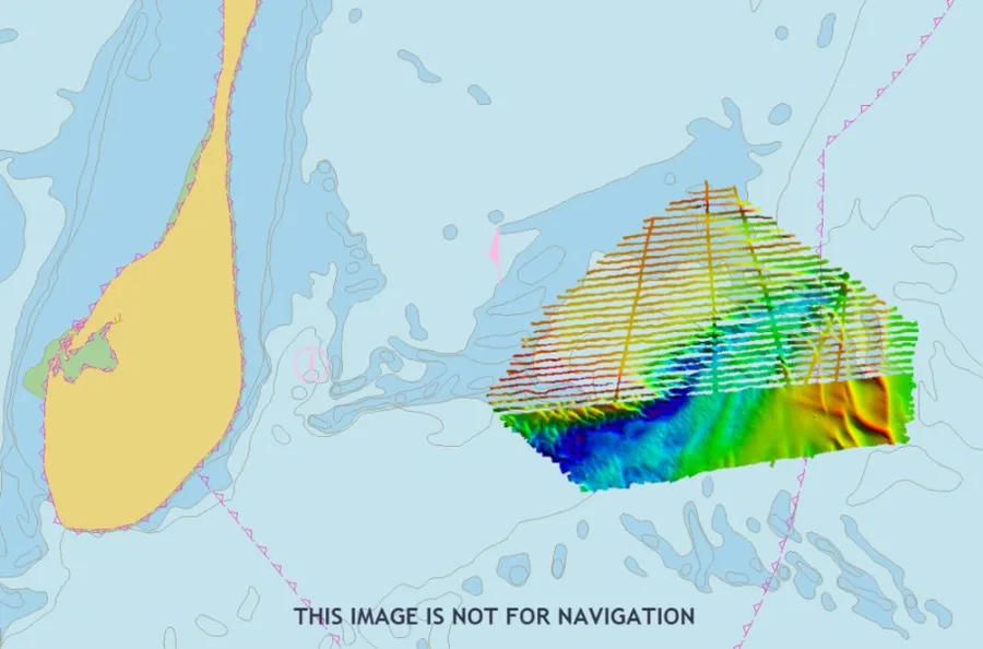
S-44 says Exclusive Order should be limited to areas with exceptional conditions and specific needs. Asking for a stricter order than navigation safety requires means paying for it. S-44 also allows different orders in different zones. Its example sets a deep route for very large tankers at Order 1a, while shallower banks can be surveyed to a stricter order. A single strict order for the whole area may waste money.
Lump sum or day rate: who carries the risk
Indonesian government procurement rules define the main contract types. Presidential Regulation 16/2018, Article 27, describes lump sum as a fixed scope and fixed price, with all risk on the provider and payment by output stage. Unit price means a fixed price per unit of work. The volume is only an estimate at signing, and the final value follows joint measurement. Check the current rules, because Regulation 12/2021 amended the 2018 text.
KPMG found the same split in survey work. Contractors on firm fixed price carry contingency risk such as weather and spare parts, and they cover it with a higher negotiated price. A time charter only guarantees a vessel and crew. It does not guarantee data that meets the standard. So a lump sum buys price certainty at a higher base price. A day rate leaves the client holding the risk of extra days.
How to read and compare quotes
Two prices often differ because the work differs, not because one bidder is cheap. A clear scope of work helps, as we explain in our guide to hydrographic survey scope of work. Ask every bidder to state the same items:
- The S-44 order and the coverage percentage.
- Equipment type, vessel size and crew number.
- Field days and processing days.
- Mobilization and demobilization, shown separately.
- Weather days assumed, and what happens when they run out.
- Certified personnel and the deliverables, as described in our client guide to survey report deliverables.
Common mistakes
The sources point to a few repeated errors. Buyers ask for a vessel or crew bigger than the job needs. They ignore the distance to site and the weather season. They leave out processing time. They also compare only the quoted price and forget their own costs. A 2017 news report on a US audit of NOAA found that in-house and contract comparisons left out several of these costs. That source is a secondary report, so read it as a warning, not a rule.
Hydrographic survey cost is not one number. It is vessel time, people, equipment, mobilization, processing and risk, set by area, depth, location and the accuracy order you request. Ask each bidder to price the same order, coverage and days, then compare. To discuss your own scope, see our hydrographic and bathymetry survey services.
References
- Rob Berlijn, "Low-budget Hydrography: the Hows and Whys," Hydro International, 2 March 2007, https://www.hydro-international.com/content/article/low-budget-hydrography-the-hows-and-whys-2
- NOAA Office of Coast Survey, "Hydrographic Survey Cost Comparison - Methods and Procedures," NOAA, 11 May 2005, https://nauticalcharts.noaa.gov/hsrp/admin/aug2005/hydrosurvey_costcomp_5_11_05.pdf
- KPMG Consulting for NOAA, "Consulting Services in Support of Hydrographic Surveys in Alaska and the Gulf of Mexico," 2001, https://nauticalcharts.noaa.gov/hsrp/archive/july2004/KPMGReport.pdf
- US Army Corps of Engineers, "EM 1110-2-1003 Hydrographic Surveying," Chapter 6, 1 January 2002 edition, https://www.discountpdh.com/wp-content/themes/discountpdh/pdf-course/planning-processing-surveys-civil-works-projects.pdf
- International Hydrographic Organization, "S-44 IHO Standards for Hydrographic Surveys, Edition 6.0.0," September 2020, https://www.transpordiamet.ee/sites/default/files/documents/2021-08/S-44_Edition_6.0.0_EN.pdf
- US Bureau of Reclamation, "Reservoir Survey Cost Estimating - Version 2," Technical Report ENV-2023-086, August 2023, https://www.usbr.gov/tsc/techreferences/reservoir/ReservoirSurveyCostEstimatingVer2TechRpt_08-2023_508.pdf
- Woods Hole Oceanographic Institution, "Charge Day Terminology," https://www.whoi.edu/what-we-do/explore/cruise-planning/cruise-planning-before-the-cruise/cruise-planning-logistics/charge-day-terminology
- Presiden Republik Indonesia, "Peraturan Presiden Nomor 16 Tahun 2018 tentang Pengadaan Barang/Jasa Pemerintah," Article 27, https://jdih.kemenkeu.go.id/FullText/2018/16TAHUN2018PERPRES.pdf
- NOAA Office of Coast Survey, "Hydrographic Surveys Contract Vehicle," NOAA, https://nauticalcharts.noaa.gov/data/hydrographic-surveys-contract-vehicle.html
- Marine Technology News, "Hydrographic Survey Spending in Question," 15 June 2017, https://www.marinetechnologynews.com/news/hydrographic-survey-spending-question-549500
Related Articles