Hydrography
Interferometric Swath Bathymetry: A Different Way to Find the Same Angle
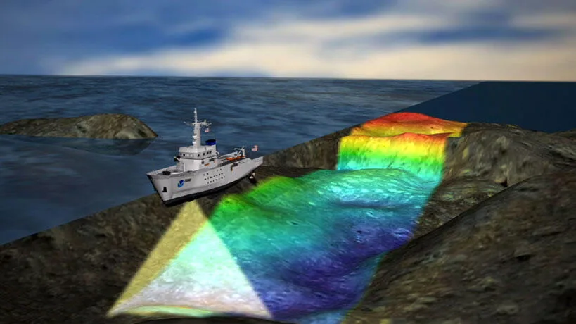
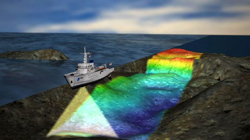
Every swath bathymetry system has to solve the same geometric problem: given a return echo, at what angle did it arrive? Multibeam echosounders, already covered elsewhere on this site, answer that question with beamforming — steering dozens of narrow, electronically-formed beams and timing each one. Interferometric systems answer it a completely different way: by measuring the phase difference of the same echo as it arrives at two vertically separated receivers. The two approaches chase the same seafloor, but the trade-offs they carry are different enough that neither one has retired the other.
Beamforming vs. Phase Difference
A beamforming multibeam echosounder (MBES) splits its receive array into many sub-apertures and applies precise time delays to each so that the combined signal is only sensitive to sound arriving from one specific angle — repeat that across the array and you get dozens to hundreds of simultaneous, independently steered beams, each one a genuine measurement of range and angle. An interferometric system takes a shortcut: instead of forming many narrow beams, it typically transmits and receives with only two wide beams, one to port and one to starboard, and divides each receive array into two vertically offset sub-arrays. The phase shift between the signals received by those two sub-arrays, as a function of two-way travel time, is what encodes the angle of arrival — the moment that phase shift crosses zero corresponds to the seafloor return exactly at the beam's center angle.
A Shallow-Water Lineage
The technique traces back further than most swath bathymetry users realize. An experimental phase-measuring bathymetric side-scan system operating at 410 kHz was demonstrated by Denbigh in 1977, aimed specifically at shallow-water applications where a full beamforming array was impractical. Similar systems followed in the UK (Bathyscan) and Norway (Topo-SSS) through the early-to-mid 1980s, and a parallel line of development — a collaboration between International Submarine Technology Corporation and the Hawaii Institute of Geophysics — produced the SeaMARC II system, combining sidescan imagery with interferometric bathymetry from the same phase-difference principle. By the time GeoAcoustics Ltd delivered its first commercial GeoSwath system in 2000, interferometric sonars had matured into genuinely practical wide-swath shallow-water tools, and the product line has continued through the current GeoSwath 4.
The Trade-off: Wider Swath, Noisier Soundings
The headline advantage of interferometry is swath width relative to platform size. Where a beamforming MBES is typically limited to a usable swath of about 3 to 5 times water depth, interferometric systems routinely reach 10 to 12 times water depth — and because the figure scales with sensor altitude rather than depth beneath the keel in the same way, interferometric sonars remain effective at grazing angles and altitudes where beamforming geometry becomes unreliable. That is exactly why the technique suits very shallow water and lightweight platforms: a GeoSwath-class sensor mounted on a small, low-draft hull can insonify a corridor many times its own operating depth without needing the long, rigid receive array a comparable-swath MBES would require.
The trade-off shows up in data quality, not just headline specifications. A direct precision comparison published through the IHO's International Hydrographic Review found that a phase-measuring bathymetric side-scan (PMBS) system met IHO S-44 Special Order for its theoretical, a-priori uncertainty budget — but only reached the looser Order 1a threshold once actual node-to-node data dispersion (a-posteriori uncertainty) was measured, despite collecting 2.4 to 5.6 times the ping density per grid node compared to the multibeam it was tested against. The multibeam, over the same seafloor, met Special Order on both criteria with markedly lower scatter. The same study reported PMBS was measurably more depth-efficient in water shallower than about 15 metres, and recommended it specifically for restricted, low-gradient areas within that depth range rather than for the highest-order surveys demanding the tightest possible vertical uncertainty.
Case in Point: A USV on the River Aire
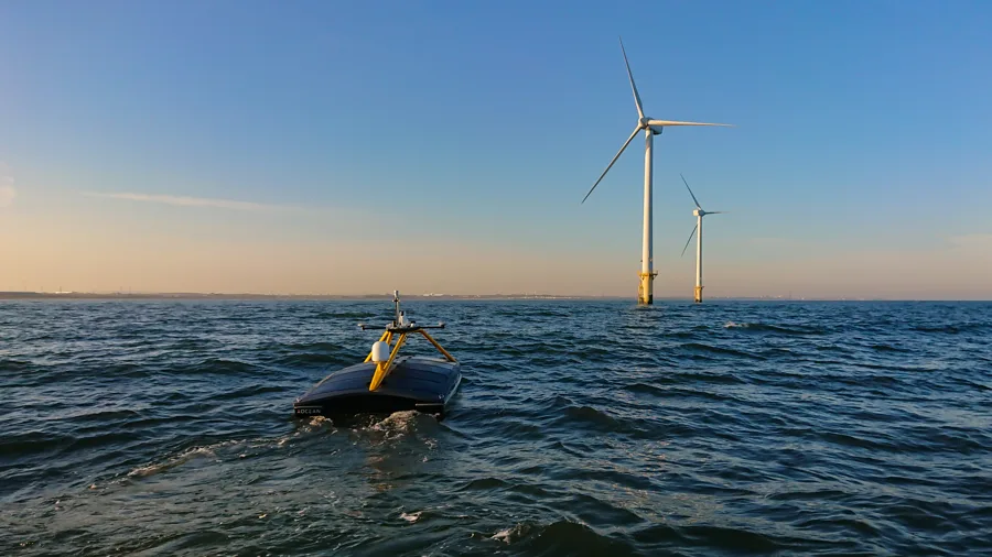
Storm Geomatics needed to survey a shallow, fast-flowing 250-metre stretch of the River Aire near Newlay, Yorkshire — bank to bank, around a weir and a rapid-flow section, in conditions that made putting a crewed survey vessel in the water both difficult and unsafe. The solution paired a GeoSwath4 interferometric sonar with an OceanAlpha SL40 uncrewed surface vessel and an SBG Ekinox motion sensor. The USV's shallow draught combined with the sonar's wide swath let the team complete a full bank-to-bank bathymetric survey without exposing personnel to the river's fast-flowing sections, feeding a 3D model and hydraulic simulation in Flood Modeller Pro that would otherwise have required a much more conservative — and more expensive — survey approach.
Choosing Between Them
In practice the decision rarely comes down to interferometry versus beamforming in the abstract — it comes down to what the platform can carry and what order of survey the project actually requires. A large hull with room for a permanently mounted transducer array, working to Special or Exclusive Order in water where slope and seafloor complexity matter, is still multibeam territory. A shallow river, a hazardous nearshore corridor, or any project where a lightweight USV or small survey launch is the only safe or economical way to get the job done is where interferometric bathymetry earns its keep — provided the survey specification can tolerate Order 1a rather than Special Order uncertainty.
References
- International Hydrographic Review, "Evaluation of the Precision of Phase-Measuring Bathymetric Side Scan Sonar Relative to Multibeam Echosounders," https://ihr.iho.int/articles/evaluation-of-the-precision-of-phase-measuring-bathymetric-side-scan-sonar-relative-to-multibeam-echosounders/
- University of New Hampshire Center for Coastal and Ocean Mapping, "State of the Art in Swath Bathymetry Survey Systems," https://scholars.unh.edu/cgi/viewcontent.cgi?article=1901&context=ccom
- R2Sonic, "Differences Between Multibeam and Interferometric Side Scan Sonars," https://r2sonic.com/interferometric-side-scan-sonar-vs-mbes/
- Kongsberg GeoAcoustics, "GeoSwath 4 USV — Bathymetric Sonar," https://www.geoacoustics.com/products/geoswath-4-usv
- Hydro International, "Employing a USV for a Wide-swath Bathymetric River Survey," https://www.hydro-international.com/content/news/employing-a-usv-for-a-wide-swath-bathymetric-river-survey
- Kongsberg Maritime, "GeoSwath Sonars Play a Key Role in South Australia Port Development," https://www.kongsberg.com/maritime/about-us/news-and-media/news-archive/2009/geoswath-sonars-play-a-key-role-in-south-australia-port-development
Related Articles