Marine Survey Technology
Marine Gravimetry: How Surveyors Measure Gravity From a Moving Ship
On land, measuring gravity is almost mundane: set a sensitive instrument on a stable tripod, let it settle, and read the tiny differences in gravitational acceleration from one point to the next. At sea, that same measurement was assumed impossible for decades. A ship never truly sits still — waves, swells, and its own motion produce accelerations thousands of times larger than the gravity signal a geophysicist actually wants to isolate. Getting a usable number out of that noise took a specific, and fairly strange, engineering solution: taking the instrument underwater.
Why Gravity at Sea Seemed Unmeasurable
A land gravimeter works by tracking an extremely small change in the position or oscillation of a test mass — a pendulum's swing period, or the stretch of a fine spring — because that motion is directly proportional to the local gravitational acceleration. The measurement only works because the sensor's platform is, for practical purposes, motionless. On a ship, that assumption collapses entirely. Wave action alone produces horizontal and vertical accelerations far larger than the gravity anomalies geophysicists are trying to detect, which are often just a few parts per million of gravity's total value. For most of the early twentieth century, that was treated as a fundamental barrier rather than an engineering problem waiting for a clever answer.
Vening Meinesz's Two-Pendulum Solution
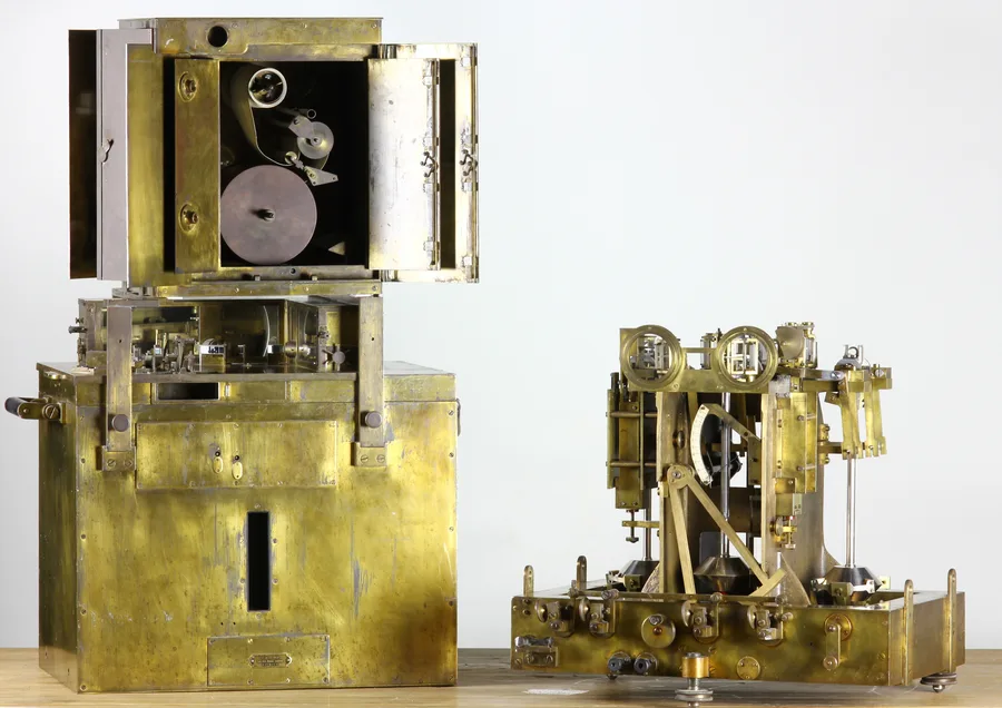
The barrier gave way in 1923, when Dutch geodesist Felix Vening Meinesz achieved gravity measurements at sea precise enough to be scientifically useful — on the order of 4 to 5 milligals. His insight was mechanical rather than purely mathematical: instead of one pendulum, he swung two of identical size in the same frame, moving in opposite phase to each other. Any horizontal acceleration from wave motion — the disturbance that ruins a single-pendulum reading — pushed both pendulums the same way at the same time, and by measuring the difference in their swing rather than either pendulum alone, that disturbance canceled out almost entirely. For submarine work, where the goal was even better isolation from surface wave motion, he adapted the design into a three-pendulum version, with a freely hung central pendulum flanked by two swinging in phase-opposed unison, all kept vertical using a two-axis gimbal mount.
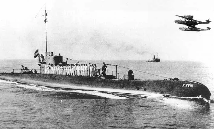
Vening Meinesz took the apparatus to sea aboard a succession of Dutch Royal Navy submarines — HNLMS K II in 1923, K XI in 1925, and K XIII across 1926–1930 — recognizing that a submarine cruising 30 meters or more below the surface experiences dramatically less motion than any vessel riding on top of the waves. His most ambitious expedition, an eight-month, 1934–35 voyage aboard HNLMS K XVIII that ran from the Netherlands down through Dakar, South America, Cape Town, Mauritius, and Fremantle before reaching Surabaya, gathered around 240 individual gravity measurements at a precision of just a few milligals — accuracy that, by some comparisons, rivals what present-day satellite gravity missions achieve. The voyage became enough of a public sensation that it was turned into a Dutch newsreel documentary the same year.
The scientific payoff matched the technical achievement. Vening Meinesz's surveys revealed elongated belts of strongly negative gravity anomalies running parallel to the deep ocean trenches of the Indonesian archipelago — a pattern he interpreted as evidence of the Earth's crust buckling downward at those trenches. Those anomaly belts, later termed Vening Meinesz belts, became part of the observational foundation that plate tectonics theory would eventually have to explain, decades before the theory itself was widely accepted.
From Pendulums to Springs: Modern Marine Gravimeters
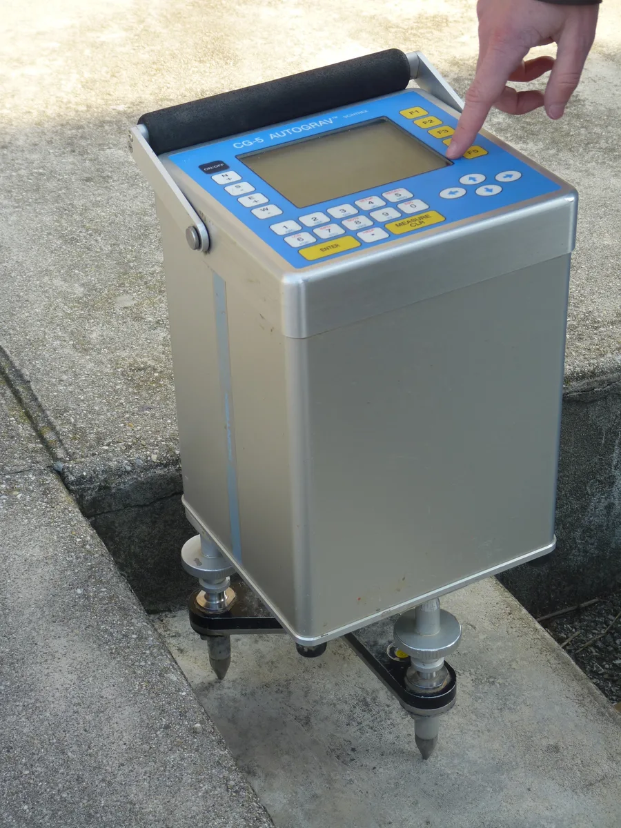
Pendulum gravimeters were eventually superseded by spring-based instruments, following a design Lucien LaCoste and Arnold Romberg first developed in 1936 and later adapted specifically for shipborne use in 1965. Rather than timing a swinging pendulum, a spring gravimeter measures the tiny deflection of a precisely calibrated spring suspending a small test mass — a more compact and mechanically simpler approach, but one that still has to survive being mounted on a moving ship. Modern marine gravimeters solve that by riding on a gyro-stabilized platform that keeps the sensor's measuring axis vertical regardless of the vessel's roll and pitch, isolating the instrument from most of the disturbance that once made a surface-ship measurement worthless.
What can't be isolated mechanically has to be corrected mathematically. A moving ship's own velocity and heading change the apparent pull of gravity the instrument records, because moving east or west adds to or subtracts from the centrifugal effect of the Earth's own rotation — an effect known as the Eötvös correction. Getting that correction right to within about 1 milligal requires knowing the ship's velocity to better than 0.1 meters per second and its heading to better than about 1 degree, which is one of the main reasons marine gravimetry only became routinely precise once GPS-derived positioning was good enough to support it. A related correction, for cross-coupling between the ship's horizontal accelerations and the sensor's own response, addresses a second, more subtle source of dynamic error in the same instruments.
A Complementary View From Orbit: Satellite-Derived Marine Gravity
Ships can only measure gravity where they've actually sailed, which leaves enormous stretches of open ocean uncovered by direct shipboard readings. Satellite altimetry fills much of that gap indirectly: sea surface height itself bulges and dips in response to the same gravitational anomalies affecting the seafloor beneath it, so a satellite precisely tracking ocean surface height can be used to infer the gravity field below. Work by David Sandwell at Scripps Institution of Oceanography and Walter Smith at NOAA, drawing on data from the Geosat and ERS-1 missions, produced global marine gravity grids that gave researchers their first near-complete picture of ocean-wide gravity variation, later refined further using data from missions such as CryoSat-2 and Jason-1. Satellite-derived gravity doesn't replace shipboard survey — its resolution is coarser, and it can't substitute for the precision a gravimeter delivers along a specific survey line — but it's an effective complement for regional context in areas no ship has ever crossed.
What Marine Gravity Data Is Actually Used For
Marine gravity surveys are a standard early step in offshore oil and gas exploration, precisely because they're faster and cheaper to run than seismic reflection surveys while still revealing broad structural trends in the rocks beneath the seafloor. Rather than replacing seismic work, a gravity survey is typically run ahead of it, helping define where a more expensive seismic campaign should actually be pointed to get the most useful results per dollar spent. Beyond resource exploration, gravity data continues to do the job it did for Vening Meinesz nearly a century ago: revealing variations in crustal thickness and composition, tracking tectonic processes at plate boundaries, and — echoing the trench anomaly belts he first mapped in the 1920s — helping characterize the geodynamics of subduction zones today.
Conclusion
Marine gravimetry's history is a reminder that a measurement written off as impossible often just needs the right engineering workaround rather than a fundamentally new idea — Vening Meinesz didn't invent a new physics, he found a way to keep his pendulums still enough for physics that already worked on land to keep working at sea. A century on, the tools have changed from swinging brass pendulums photographed on film to gyro-stabilized spring sensors corrected by GPS and cross-checked against satellite altimetry, but the underlying question a marine gravity survey answers is exactly the one Vening Meinesz first managed to ask from the deck — or rather, from inside the hull — of a Dutch submarine.
References
- Watts, A.B. (2011) — Gravity at Sea — A Memoir of a Marine Geophysicist, PMC (National Institutes of Health)
- Wikipedia — Felix Andries Vening Meinesz; HNLMS K XVIII
- SEG Wiki — Lucien LaCoste
- Sandwell, D.T. & Smith, W.H.F. — Marine Gravity Anomaly from Geosat and ERS-1 Satellite Altimetry, Journal of Geophysical Research: Solid Earth
- Sandwell, D.T., Müller, R.D., Smith, W.H.F., Garcia, E. & Francis, R. (2014) — New Global Marine Gravity Model from CryoSat-2 and Jason-1 Reveals Buried Tectonic Structure
- Geology Science — Gravity Surveys: Basic Principles and Applications
- Wikimedia Commons — Vening Meinesz Pendulum Apparatus; HNLMS K XVIII, 1935; Autograv CG-5 Gravity Meter
.JPG)
.jpg)

Related Articles
Applications of Marine Magnetometers and Gradiometers: The Instrument That Sees Iron, Not Shape
Positioning Systems in Marine Survey: From GPS Satellites to Seafloor Transponders