Hidrografi
Surveying Small-Scale Fishing Harbors: Why the Cheapest Method Is Often the Right One
A survey for a new container terminal and a survey for a village fish-landing site are both, technically, hydrographic surveys — but the resemblance mostly ends there. A local government or fishing cooperative planning a small jetty or landing site does not need an IHO Special Order survey vessel, a multibeam array, or a six-figure mobilization budget. What it does need is a handful of well-chosen, low-cost measurements taken correctly, because the two failure modes that sink small harbor projects — building to the wrong depth, and forgetting that the seabed keeps moving after construction — are avoidable with equipment that fits in a canoe.
Five Measurements, Not One Big Survey
The FAO's long-standing guidance for artisanal harbor and village-landing construction breaks a site survey into five components: a topographic map of the shore (paths, wells, vegetation, existing structures), a contour map of the sea-bottom depths in and around the proposed shelter, a tide survey recording the maximum and minimum water levels, a tidal-stream survey mapping current direction and strength, and a wave-height survey documenting direction, frequency and intensity. None of these individually requires expensive instrumentation — but skipping any one of them is how a landing gets built at a depth that only works on a good day.
The tide survey matters more than it looks. Tidal range at a candidate site can be "as little as 100 mm and as much as several metres" depending entirely on local geography, and a design based on an assumed range rather than a measured one is a design based on a guess. The same logic applies to the bathymetric contour map: FAO guidance recommends extending the sounding survey 50–100 m beyond the footprint of the proposed shelter or landing on either side, so the design accounts for the seabed the harbor will actually sit next to, not just the seabed directly underneath it.
Two Kits, Two Budgets
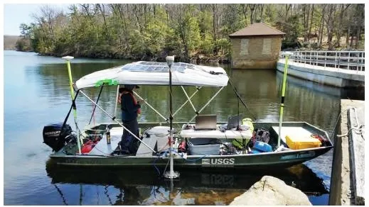
FAO's field manual splits the equipment list into what it frankly calls the expensive group — theodolite, level, tripod, staff, and an echosounder, all realistically hired or borrowed rather than bought — and the affordable group: an optical square, tape measures from 20 to 100 m, a compass, ranging rods and float-lines, a sounding chain weighted with a 1 kg lead, and a survey boat, timber-built by preference for stability. A trained team can produce a usable bathymetric contour map from the affordable kit alone, provided the positioning method is disciplined.
Two positioning methods cover most small-site needs. The ray method uses a theodolite at a fixed vantage point with buoys positioned at 5–10 degree angular intervals roughly 200 m out — fast, but less precise. The parallel line method is more accurate: a baseline of 100 m or more is set out on shore, with offshore buoys placed perpendicular to it every 5–10 m. Whichever method is used, the sounding chain must reach the bottom in a straight vertical line, readings are taken every 5–10 m along each float-line, and the survey boat has to sit still while each reading is taken — small details that determine whether the resulting contour map is trustworthy or merely decorative.
Case Study: A Slope You Can Design Around
At Pekalongan Nusantara Fishery Port on Java's north coast, a bathymetric survey conducted to plan basin dredging found an average seabed slope of about 3.332% across the port pool — a gentle, evenly graded bottom — and used that data, combined with the port's planned depth, to set a maximum permitted vessel draft of 3.068 m for boats entering the harbor. That is exactly the kind of number a contour survey is supposed to produce: not an abstract depth chart, but an operating rule a harbor master can actually enforce.
Case Study: Why the Survey Has to Come Back
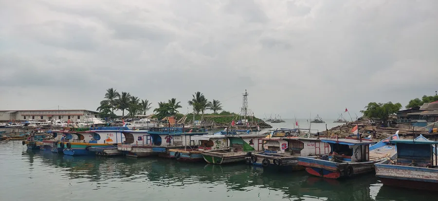
Palabuhan Ratu Nusantara Fishing Port, also in West Java, illustrates the second failure mode. A 2017 IPB University thesis tracked sedimentation in the port's two basins using sediment traps alongside water discharge, total suspended solids, tidal, and current measurements, then cross-checked the results against depth-change analysis from repeated soundings. Basin 1 accumulated sediment at roughly 0.05 m/year by direct trap measurement but 0.15 m/year by volume calculation from re-surveyed depths; Basin 2 showed 0.02 m/year and 0.05 m/year respectively. The Cipalabuhan River's own contribution to siltation rose from about 0.06 m/year in the dry season to 0.10 m/year during the rains. Basin depths measured between 0–3.7 m in Basin 1 and 0–4.5 m in Basin 2, and at the study's average combined rate of roughly 0.46 m/year, the researchers projected Basin 1 would need re-dredging on a seven-year cycle, with the next round due in 2024.
Neither of those numbers required a survey vessel or a multibeam system — sediment traps, tide staffs, and repeated soundings from a small boat produced data precise enough to schedule a dredging budget years in advance. That is the practical case for right-sizing a harbor survey to the harbor: a fishing cooperative does not need Order 1a positioning accuracy to know it needs to dredge again in 2024, it needs a measurement taken carefully and repeated on schedule.
Scaling the Survey to the Harbor
The instinct to under-survey a small project is understandable — the budget is small, so the technical effort should be too. The FAO framework suggests the opposite lesson: the effort should scale down in cost, not in rigor. A tide survey, a contour map extended past the harbor footprint, a disciplined positioning method, and a commitment to re-survey on a known interval will catch the problems that actually sink small-harbor projects, at a fraction of the cost of the commercial-port toolkit designed for a different scale of consequence entirely.
References
- FAO, "Construction and Maintenance of Artisanal Fishing Harbours and Village Landings — Making a Site Survey," https://www.fao.org/4/V5270E/v5270e02.htm
- FAO, "Fishing Harbour Planning, Construction and Management," https://www.fao.org/4/i1883e/i1883e.pdf
- Rahman, Berri Miraz Kholipah, "Laju Sedimentasi dan Perubahan Kedalaman di Kolam Pelabuhan Perikanan Nusantara Palabuhanratu," IPB University Repository, 2017, https://repository.ipb.ac.id/handle/123456789/89885
- "Analisis Batimetri untuk Evaluasi Pendangkalan di Kolam Pelabuhan Perikanan Nusantara Pekalongan," Indonesian Journal of Oceanography, Universitas Diponegoro, https://ejournal2.undip.ac.id/index.php/ijoce/article/download/19878/14294
- American Society of Civil Engineers, "Planning and Design Guidelines for Small Craft Harbors," 3rd ed., https://ascelibrary.org/doi/book/10.1061/9780784411988
Related Articles