Platform & Operasi Survei
Survey for Land Reclamation and Artificial Island Projects: Tracking Fill, Not Removing It
A dredging survey exists to answer a subtraction question: how much material came out, and does the resulting seabed match the design depth. A reclamation survey answers the opposite question — how much material went in, whether it landed where the design says it should, and whether the ground it's sitting on will still be there once the load of a building or a runway comes down on top of it years later. That difference in direction changes what gets measured, how often, and for how long: a reclamation project's survey work doesn't really end when the fill breaks the surface of the water, it just changes from a hydrographic problem into a geotechnical one.
Three Surveys, Not One
Reclamation and land-forming projects are generally tracked through a sequence of pre-fill, progress, and post-fill bathymetric surveys, the same three-stage structure used on capital dredging work but run in reverse: a baseline survey establishes the existing seabed before any material is placed, progress surveys during filling monitor how much material has been deposited and whether it is accumulating within the design footprint, and post-placement surveys confirm the fill has reached its design elevation. Because reclamation is an additive process, progress surveys typically run on a tighter cycle than a comparable dredging job — quality-control bathymetric checks after fill placement are commonly carried out within 24 to 48 hours of a placement event specifically to confirm the material distributed the way the design intended before the next lift goes down on top of it.
The instruments doing the measuring are the familiar hydrographic toolkit — multibeam or single-beam echosounders for the underwater portion of the fill, real-time kinematic GNSS for the exposed portion once it breaches the surface — but the volumetric comparison itself works by differencing successive surface models against the pre-fill baseline rather than against a single target dredge depth, since a reclamation project's "finished" elevation is usually a few meters above the original seabed, not a cut below it. What is genuinely different from a dredging volume computation is that a fill survey often has to account for what happens to the material after it's placed: hydraulically pumped fill settles and consolidates over time, so a volume that reads as "reached design elevation" the week it's placed can read short of that elevation months later as the sediment column below it compresses under its own weight.
Case Study: Palm Jumeirah — Positioning Every Meter of Sand as It Was Placed
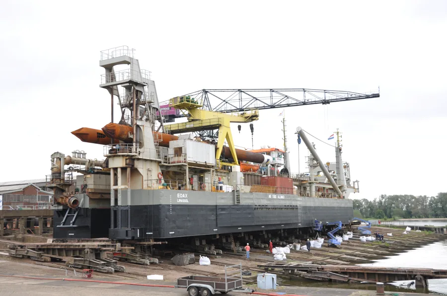
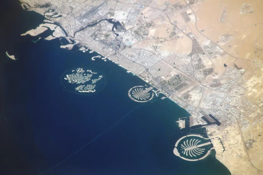
Dubai's Palm Jumeirah was built from roughly 94 million cubic meters of sand and 5.5 million cubic meters of rock, most of the sand dredged from banks around 11 kilometers offshore and pumped into shape by cutter suction dredgers over a construction period that ran from 2001 to late 2003. Because the island's frond-and-crescent geometry had to be built to a precise design shape rather than simply filled to a depth, the project's survey strategy leaned on real-time positioning rather than periodic bathymetric snapshots alone: survey teams walked the perimeter of the fronds daily with GPS receivers, staying in direct contact with the dredger operators to guide sand placement, with the project's differential GPS control reported to have kept placement accuracy within about a centimeter of the design template. Once the reclaimed sand was in place, a separate process — vibrocompaction, which densifies loose granular fill using vibrating probes driven into the ground — was needed before the material could be treated as a stable foundation for construction, a step that exists precisely because freshly placed hydraulic fill is not automatically load-bearing just because it has reached the right elevation.
Case Study: Changi East — When the Survey Has to Run for Years After the Fill Is In
Singapore's Changi East reclamation, which placed roughly 200 million cubic meters of sand over about 3,000 hectares of former sea between 1992 and 2004, illustrates the other half of a reclamation survey's job: proving the ground stays put after the fill has already reached grade. Because much of the site sat over soft marine clay, the project installed a geotechnical monitoring network reported at more than 7,200 instruments — surface and multi-level settlement gauges, piezometers, inclinometers, and deep reference points — to track how far and how fast the underlying clay was consolidating under the new load. Settlement-gauge readings were analyzed using methods such as the Asaoka technique, which extrapolates a still-ongoing settlement curve to estimate its final, fully-consolidated value, letting engineers judge when a filled area had settled enough to be handed over for construction rather than waiting out the full consolidation period in real time. That is a fundamentally different question from anything a dredging survey has to answer: a dredged channel doesn't keep sinking after the dredger leaves, but a filled one does, for years, and the survey and monitoring program has to keep proving that settlement is converging on a stable value rather than continuing indefinitely.
A Survey That Doesn't Stop at the Waterline
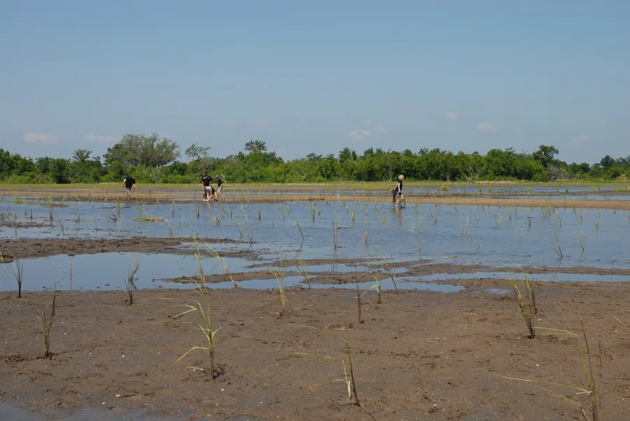
A reclamation project's survey scope only looks like a mirror image of a dredging survey while the fill is still underwater. Once it breaks the surface, the job keeps going in a form a dredging contract never has to budget for: settlement plates, piezometers, and repeat topographic surveys running for months or years to confirm that what was placed at design elevation is going to stay there once the load of roads, buildings, or runway pavement comes down on top of it. Getting the volume of fill right at the moment of placement, the way Palm Jumeirah's daily perimeter surveys did, answers only the first half of the question a reclamation project actually needs answered — the second half, the one Changi East's instrumentation network spent over a decade tracking, is whether the ground underneath is finished moving.
References
- IADC (International Association of Dredging Companies), "Surveying and Monitoring," https://www.iadc-dredging.com/subject/surveying-monitoring/
- CUR/CIRIA, "Hydraulic Fill Manual: For Dredging and Reclamation Works," https://www.ancientportsantiques.com/wp-content/uploads/Documents/ENGINEERING/Maritime/HydraulicFillManual-CUR2012.pdf
- "Building the Palm Jumeirah," AZoBuild, https://www.azobuild.com/article.aspx?ArticleID=8135
- "Land in Water: The Study of Land Reclamation and Artificial Islands in the Modern Era," Land (MDPI), https://www.mdpi.com/2073-445X/11/11/2024
- "Instrumentation at Changi Land Reclamation Project, Singapore," Proceedings of the Institution of Civil Engineers – Geotechnical Engineering, https://www.researchgate.net/publication/245407910_Instrumentation_at_Changi_land_reclamation_project_Singapore
- "Research Oriented Ground Improvement Projects in Changi, Singapore," ResearchGate, https://www.researchgate.net/publication/329526570_Research_oriented_ground_improvement_projects_in_Changi_Singapore
Related Articles