Geofisika & Geohazard
Surveying for Deep-Sea Minerals: Why Nodule Fields and Hydrothermal Vents Need Two Different Playbooks
Deep-sea mineral exploration is often talked about as one industry, but it is really surveying two almost unrelated kinds of deposit. Polymetallic nodules lie scattered thinly across vast, flat abyssal plains 4,000 to 6,000 metres down — a resource defined by its abundance per square metre over huge areas. Seafloor massive sulfides form in tight clusters around active hydrothermal vents, a few hundred metres across but extraordinarily rich. Surveying one is a regional mapping problem; surveying the other is closer to exploration drilling. The instruments overlap, but the strategy behind them does not.
A Discovery from 1873 That Took a Century to Matter
Manganese nodules were first hauled up from the seafloor on 18 February 1873, 300 kilometres southwest of the Canary Islands, during the voyage of HMS Challenger — the expedition that effectively founded modern oceanography. Naturalist John Murray, the expedition's sediment specialist, later co-authored the 1891 report describing them, but for nearly a century the nodules remained a scientific curiosity rather than a resource target. That changed in 1970, when Deepsea Ventures Inc. ran the first attempt to mine them commercially, airlifting nodules from 800 metres of water on the Blake Plateau off Florida. By the summer of 1978, three international pilot mining test consortia — most notably Ocean Management Incorporated, and separately Ocean Mining Associates with its vessel Deepsea Miner II — had demonstrated nodule recovery from the Clarion-Clipperton Zone at depths of roughly 4,500 metres, with Deepsea Miner II reportedly reaching its design capacity of 50 tons of nodules per hour. None of these 1970s ventures became commercially viable, but they proved the basic engineering was possible decades before the regulatory and environmental frameworks needed to actually permit it existed.
Surveying a Resource That Is Defined by Its Patchiness
The International Seabed Authority (ISA), established in 1994 under the UN Convention on the Law of the Sea, now administers exploration contracts covering 75,000 km² each for nodule fields, mostly concentrated in the Clarion-Clipperton Zone (CCZ) between Hawaii and Mexico. What a survey there is actually trying to resolve is nodule abundance — the mass of nodules per square metre of seafloor — because that figure varies enormously and unpredictably over short distances. Resource-grade CCZ ground can carry a measured abundance around 12.8 kg/m² grading roughly 1.30% nickel, 0.20% cobalt, 1.2% copper, and 30.2% manganese, but abundance across the CCZ as a whole ranges from as little as 1.5–3 kg/m² in the south up to 7.5 kg/m² in the east — meaning a survey grid has to be dense enough to characterise that patchiness, not just confirm the nodules are present.
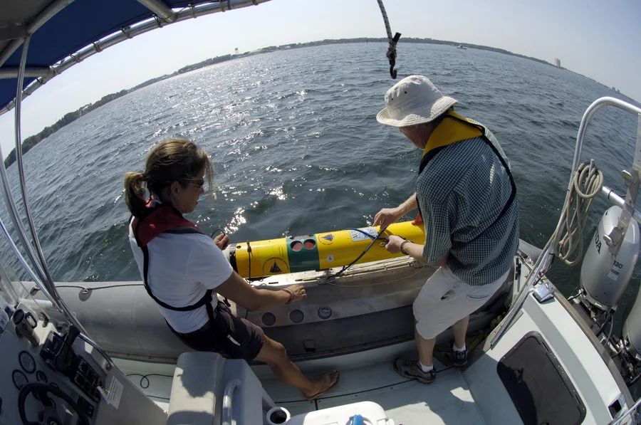
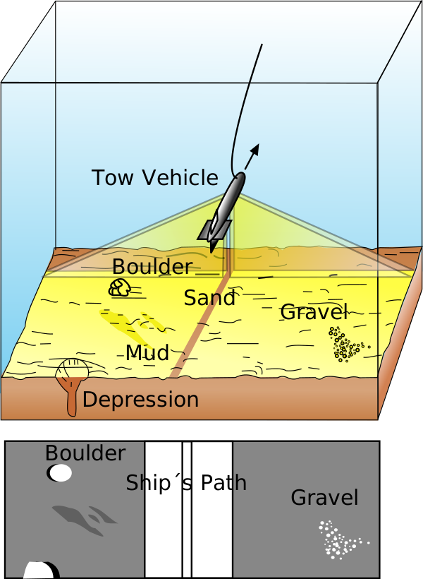
In practice that means layering three data types: shipborne multibeam echosounder and side-scan sonar for regional bathymetry and backscatter, then AUV-borne high-resolution multibeam and synthetic-aperture sonar for finer texture, and finally seafloor photography — an AUV flown at roughly 3 metres altitude and 1.2 m/s, firing its camera every 850 milliseconds, with each frame imaging about 1.7 m² of seabed. Because that generates an enormous number of images for even a modest survey area, recent nodule-coverage assessments increasingly hand the classification step to deep convolutional neural networks trained to separate nodules from bare sediment and estimate percentage coverage automatically rather than by manual image review.
Case Study: What Two Nodule-Collector Trials Actually Measured
Two recent pilot trials show how much of a modern nodule "survey" is now inseparable from environmental monitoring. In April 2021, Belgian contractor Global Sea Mineral Resources (GSR) ran its Patania II collector vehicle on the CCZ seafloor at roughly 4,500 metres depth for about 50 hours — a trial that included a widely reported temporary stranding of the robot — while scientists from 29 European research institutes, working alongside German contract holder BGR, independently monitored sediment plume behaviour and seafloor disturbance in parallel. The following year, The Metals Company's subsidiary NORI partnered with Allseas to trial a prototype collector vehicle feeding nodules up a riser to the surface vessel Hidden Gem, lifting more than 3,000 tonnes of nodules to the surface from the NORI-D exploration area. Around that single 4 km × 2 km test field, over 50 sensors and monitoring assets were deployed, and sedimentation specialists DHI Water and Environment built a verified plume-dispersal model from the resulting dataset — concluding the sediment plume stayed low-lying near the seabed and was shaped more by seafloor terrain than by ambient currents. In both cases, the "survey" continued well past the moment the nodules left the seabed.

The Opposite Problem: Finding a Small, Rich Deposit at a Vent
Seafloor massive sulfide (SMS) deposits form where superheated, metal-laden fluid vents from the seafloor at active hydrothermal systems and precipitates sulfide minerals on contact with cold seawater — the "black smoker" plumes first characterised in detail from research submersibles in the 1970s and 1980s. The best-studied prospective deposit, Solwara 1 in the Bismarck Sea off Papua New Guinea, sits on the flank of a submarine volcanic mound at around 1,600 metres depth and covers only about 0.112 km² — three to four orders of magnitude smaller than a CCZ nodule licence area. But its grade is what makes it interesting to a surveyor: an average copper grade around 7%, roughly ten times a typical land-based porphyry copper mine, with individual seafloor drill assays returning as much as 37.7% copper and 20.8 g/t gold, against an average gold grade near 6 g/t across an indicated resource of 0.87 million tonnes and an inferred resource of 1.3 million tonnes.
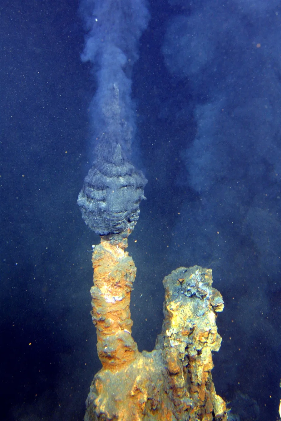
Because an SMS deposit is small, steep-sided, and chemically distinct from the surrounding seafloor, the survey toolkit shifts toward precision over coverage. Regional multibeam bathymetry and deep-towed side-scan sonar first narrow down candidate vent fields by their distinctive mound morphology and backscatter signature; ROVs then take over for close-range sampling with dredges and rock drills, exactly as they did across the resource-drilling campaign that defined Solwara 1's grade and tonnage. One geophysical method sees comparatively little use in nodule surveys but is specifically suited to vents: marine self-potential surveying, which measures naturally occurring electrical potential differences generated by the redox chemistry of a sulfide body reacting with seawater, letting a survey distinguish individual sulfide accumulations from the broader hydrothermally altered seafloor around them.
Two Deposit Types, Two Survey Philosophies
Nautilus Minerals, which held the Solwara 1 mining licence, collapsed financially in 2019 before extraction ever began, and the licence has since changed hands — a reminder that a technically successful survey campaign and a commercially successful mine are not the same milestone. But the contrast in survey approach outlives that particular project: nodule exploration is fundamentally a statistics problem solved with AUV coverage and image classification at enormous scale, while SMS exploration is fundamentally a targeting problem solved with high-resolution acoustic reconnaissance narrowed down to drill-ready precision. Any survey contractor moving between the two has to switch not just instruments, but the entire logic of what "enough data" means.
References
- Natural History Museum, London / bioRxiv — Sir John Murray's H.M.S. Challenger Sedimentary Deposits Collection
- MDPI, Journal of Marine Science and Engineering — The Development History and Latest Progress of Deep-Sea Polymetallic Nodule Mining Technology
- International Seabed Authority — Polymetallic Nodules: Exploration Contracts
- International Seabed Authority — Polymetallic Nodules (ISA Deep Seabed Minerals brochure)
- DEME Group / GSR — Metal-Rich Nodules Collected From Seabed During Important Technology Trial
- The Metals Company (GlobeNewswire) — NORI and Allseas Lift Over 3,000 Tonnes of Polymetallic Nodules to Surface
- ResearchGate / OnePetro (OTC-21645-MS) — Resource Drilling of the Solwara 1 Seafloor Massive Sulfide (SMS) Deposit
- PMC / NCBI — Marine Self-Potential Survey for Exploring Seafloor Hydrothermal Ore Deposits
Related Articles