Platform & Operasi Survei
Doppler Velocity Log: How an AUV Knows Its Speed When GPS Cannot Reach It
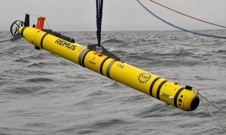
Once an autonomous underwater vehicle submerges, GPS goes silent — radio signals do not travel through seawater. Everything the vehicle knows about where it is from that point on has to be computed, not received. The Doppler Velocity Log is the sensor that makes that computation possible: not by measuring position directly, but by measuring the vehicle's own speed over the seafloor precisely enough, and often enough, that dead reckoning stops being a rough estimate and becomes a navigation solution accurate to a fraction of a percent of distance travelled.
The Same Beam Geometry, a Different Target
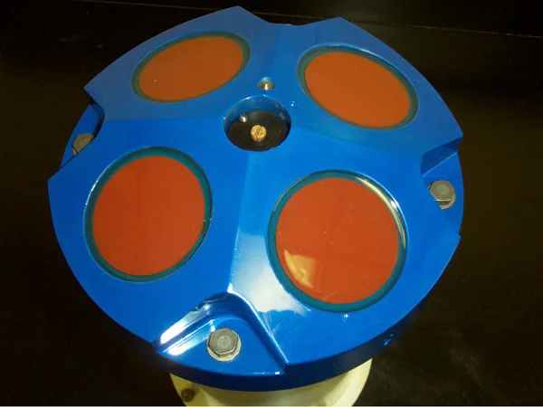
A DVL's transducer head looks almost identical to an ADCP's, and the resemblance is not superficial: both instruments transmit narrow acoustic beams in the Janus configuration — four beams arranged in an "×" pattern, each tilted away from vertical by a fixed angle (typically around 30°) — and both derive velocity from the Doppler shift between the transmitted pulse and its return. What differs is where each instrument aims that measurement. An ADCP profiles the water column, reading backscatter from suspended particles at a sequence of depth bins to build a current profile — a subject covered in detail in our companion article on acoustic Doppler current profiling. A DVL points its beams at the seafloor and reads the Doppler shift of the bottom-reflected return specifically, using it to solve for the vehicle's own velocity relative to that fixed, stationary surface. One industry technical comparison puts it bluntly: a DVL is essentially an ADCP whose beamforming and algorithms have been optimized for navigation rather than for current measurement, and the two cannot be substituted for each other — a DVL's bottom-tracking algorithm is built specifically to lock onto and range the seafloor return, not water-column backscatter.
Bottom Track, and the Water-Track Fallback
The mode a DVL runs in almost all of its operational life is called bottom track: as long as the seafloor sits within range beneath the vehicle, the four beams return a strong, well-defined Doppler shift and the instrument reports a velocity vector accurate to a small fraction of a percent. That range is not unlimited and it is frequency-dependent — a fundamental trade-off common to all Doppler sonars. Higher frequencies in roughly the 600 kHz–1.2 MHz band give tighter beams and finer velocity resolution but shallower maximum altitude, typically on the order of 100–200 metres; lower frequencies down toward 300 kHz sacrifice some precision for reach, with documented bottom-track altitudes out to roughly 400–420 metres on commercial units. When the seafloor drops out of range — descending into deep water beyond the vehicle's altitude limit, or crossing a trench — a DVL does not simply go blind. Most modern units fall back to water-track mode, functionally identical to an ADCP: they track the Doppler return from a reference layer of water instead of the bottom. This keeps a velocity estimate flowing, but it is measuring the AUV's velocity relative to a moving water mass rather than a fixed seafloor, which is a meaningfully worse reference for navigation and is treated by integrated navigation systems as a degraded, lower-confidence input.
Why Velocity Alone Is Not Position — and Why DVL Fixes That
A DVL never reports position. It reports a velocity vector, beam by beam, tens of times per second. Turning that into a navigation solution is the job of dead reckoning: integrating velocity over time, starting from a known fix, to project where the vehicle now is. Do that with an inertial navigation system (INS) alone — accelerometers and gyroscopes with no external speed reference — and the errors compound geometrically, because an unconstrained INS has to integrate acceleration twice to get position, and any small bias or noise term grows with the square of elapsed time. Add a DVL's directly measured, non-integrated velocity as an aiding input to the INS's Kalman filter, and the picture changes: the filter now has a real, frequently updated velocity observation to correct gyro drift and accelerometer bias against, and dead-reckoning error growth collapses from a function of time to something closer to a small, roughly constant percentage of distance actually travelled — because velocity error, not time, becomes the dominant term, and DVL keeps that velocity error bounded and small.
Real Numbers: Accuracy Across Commercial DVL Classes
Published specification sheets give a concrete sense of what "accurate" means in practice. Teledyne RD Instruments' Workhorse Navigator — the DVL that, launched in 1995, is widely credited as the first commercially available instrument of its kind — was rated at approximately ±0.4% of measured velocity ±0.2 cm/s for its 300 kHz variant, tightening to roughly ±0.2% ±0.1 cm/s at 600 kHz and 1200 kHz, where the shorter wavelength supports finer Doppler resolution at the cost of range. Nortek's DVL1000, a more recent 1 MHz unit aimed at compact AUV and ROV integration, is specified with single-ping accuracy around 0.8 cm/s at half its maximum altitude and long-term bottom-track accuracy of roughly ±0.1% ±0.1 cm/s, with its water-track fallback mode specified looser, at around ±0.3% ±0.3 cm/s — a quantified illustration of exactly how much confidence is lost when bottom lock drops out. Teledyne RDI retired the Workhorse Navigator and its Explorer sibling in 2020 in favor of the Tasman DVL, which pushed maximum bottom-track altitude out to roughly 420 metres while extending rated operating depth to 6,000 metres — figures that track a broader industry trend of DVLs reaching deeper and further from the seafloor without giving up navigation-grade accuracy.
Applications: From Long AUV Transits to ROV Station-Keeping
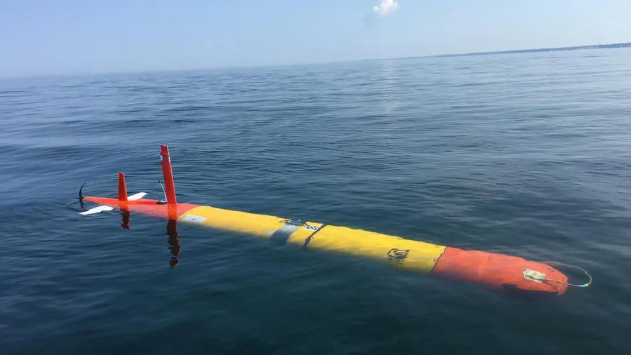
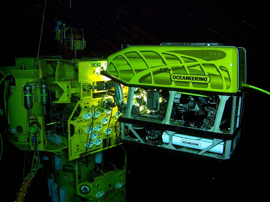
The clearest demonstration of what DVL-aided navigation buys an operator is Kongsberg's HUGIN Endurance, a long-range AUV whose Sunstone inertial navigation system fuses a Doppler Velocity Log with an inertial measurement unit, depth sensor, and compass. On a record multi-week autonomous mission covering the vehicle's full 1,200 nautical mile (roughly 2,200 km) design range at depths between 50 and 3,400 metres, the AUV received a single navigation fix from a pre-deployed transponder ten hours into the dive and then ran the remainder of the mission with no external navigation aiding whatsoever — DVL-aided dead reckoning alone. It surfaced with a position error of approximately 0.02% of total distance travelled. Sonardyne's SPRINT-Nav family, which integrates a Syrinx DVL directly with a fibre-optic or ring-laser-gyro INS in one housing, is specified across its tiers from about 0.03% down to under 0.01% of distance travelled, and is marketed explicitly for AUV, uncrewed underwater vehicle, and long ROV-excursion work where re-acquiring a surface or acoustic fix is impractical mid-mission. ROVs draw on the same measurement for a different purpose: rather than a long transit, a work-class ROV holding station over a subsea structure feeds DVL velocity into its dynamic positioning system as a bottom-referenced speed input, letting the vehicle hold a fixed position over a target even where acoustic positioning beacons are sparse or the vehicle is working close under a platform where GPS-referenced surface references are geometrically awkward to use.
The Instrument That Replaces GPS Without Replacing Its Job
It is worth being precise about what a DVL does and does not do, because the two get conflated. It does not provide position, and it does not replace GPS in the sense of delivering an absolute geographic fix — nothing acoustic does that underwater with GPS-equivalent authority. What it replaces is the role GPS plays on the surface: a continuous, high-rate, directly measured velocity reference that a navigation filter can trust between the sparse fixes — an acoustic transponder update, a brief mast-up GPS fix at the surface — that do provide absolute position. Every other sensor on an AUV's navigation stack, the IMU, the depth sensor, the compass, is either integrating something or measuring an angle. The DVL is the one sensor in the stack measuring speed over ground directly, and that is precisely the measurement dead reckoning cannot do without.
References
- Nortek, "DVL 1000 - 300 m: Doppler Velocity Log for underwater navigation," product specifications, https://www.nortekgroup.com/products/dvl-1000-300m
- Sonardyne, "SPRINT-Nav," product page, https://www.sonardyne.com/product/sprint-nav/
- Oceantek, "What Is a DVL? How Different with ADCP," https://oceanadcp.com/what-is-a-dvl-difference-between-dvl-and-adcp/
- Teledyne RD Instruments, "Workhorse Navigator Doppler Velocity Log" datasheet, hosted by British Oceanographic Data Centre, https://www.bodc.ac.uk/data/documents/nodb/pdf/rdi_workhorse_nav_ds_lr.pdf; see also Ocean News & Technology, "Next-Generation Doppler Velocity Log From Teledyne RDI," on the 2020 Navigator/Explorer retirement and Tasman DVL successor, https://oceannews.com/news/subsea-and-survey/next-generation-doppler-velocity-log-from-teledyne-rdi/
- Kongsberg, "Autonomous Underwater Vehicle, HUGIN Endurance," product page on Sunstone INS/DVL navigation, https://www.kongsberg.com/what-we-do/ocean-space/autonomous-and-uncrewed-solutions/auv/autonomous-underwater-vehicle-hugin-endurance/; case detail via Interesting Engineering, "Norway's underwater drone breaks record, swims 3400m deep autonomously," https://interestingengineering.com/innovation/norway-underwater-drone-hugin-endurance-auv
- "Underwater Doppler Navigation with Self-calibration," The Journal of Navigation, Cambridge University Press, https://www.cambridge.org/core/journals/journal-of-navigation/article/underwater-doppler-navigation-with-selfcalibration/255227D3244EE4920580A055C90D6F6E
Related Articles