Geofisika & Geohazard
Electrical Resistivity Tomography: Mapping the Seabed With Current Instead of Sound
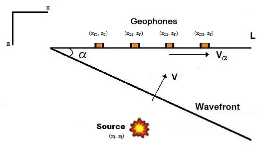
Every method covered elsewhere on this site — multibeam, side-scan, sub-bottom, seismic — reads the seabed acoustically, by timing how sound travels and bounces. Electrical Resistivity Tomography (ERT) reads it a completely different way: by pushing electrical current into the ground and measuring how hard that current has to work to get through. That different physical basis is exactly what makes ERT useful precisely where acoustic methods struggle, and it can see something acoustics cannot see at all — the salinity of the water sitting in the sediment pores.
The Physics: Ohm's Law, Not Travel Time
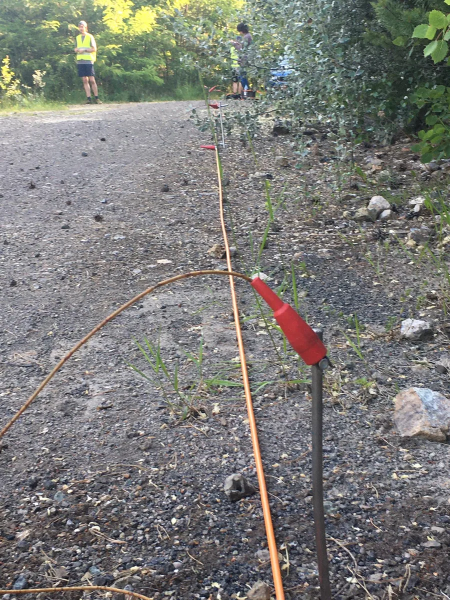
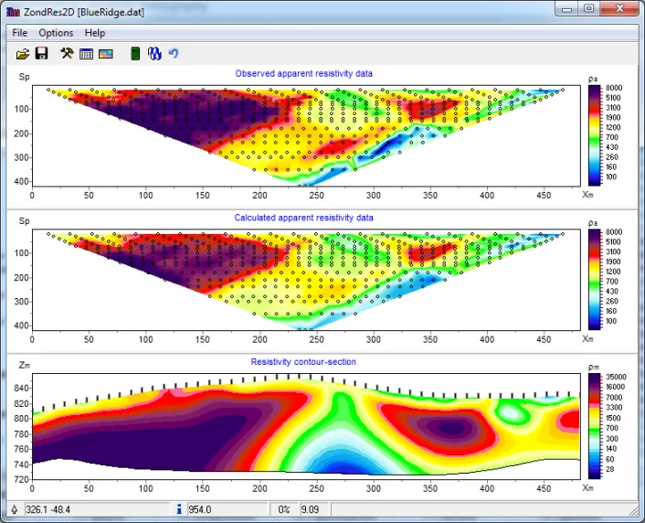
An ERT survey works by injecting electrical current into the ground through one pair of electrodes and measuring the resulting potential difference (voltage) at another pair. Combined with the known current and the geometric arrangement of the electrodes, that voltage measurement yields an "apparent resistivity" for the ground beneath the array — a value governed by Ohm's law and a geometric correction factor specific to the electrode configuration used. Repeating this across many electrode pairs and spacings, then inverting the resulting dataset, produces a resistivity cross-section of the subsurface rather than the travel-time cross-section a seismic or acoustic survey would produce.
Choosing How the Electrodes Are Arranged
The three electrode configurations used most often each trade resolution for a different strength. The Wenner array keeps all electrode spacings equal and is comparatively good at resolving vertical changes — horizontal layering — but weaker at picking out narrow vertical features. The Schlumberger array is built for vertical sounding beneath a single location and generally offers better resolution, greater depth penetration, and faster field deployment than Wenner. The dipole-dipole array has low electromagnetic coupling between its current and potential circuits and is highly sensitive to horizontal changes in resistivity — useful for locating discrete vertical features — but comparatively insensitive to vertical layering. None of the three is universally best; the choice depends on whether the survey target is a layered structure or a discrete anomaly.
Where Acoustic Methods Run Into Trouble
Acoustic survey methods lose most of their effectiveness in gas-saturated sediment, because gas bubbles scatter and absorb acoustic energy before it can penetrate or return a usable signal — the same shallow-gas problem that produces acoustic "blanking" on a sub-bottom profiler record. Electrical current doesn't share that weakness, which is why practical guidance for coastal geophysical survey work recommends electric prospecting methods specifically for conditions where hydroacoustic methods are limited by gas-bearing sediment. ERT is rarely deployed as a replacement for acoustic survey, though — the more common approach is to run it alongside multibeam bathymetry and magnetic survey, because combining electric, magnetic, and acoustic datasets reduces the interpretive ambiguity that any single method carries on its own.
Tracing Where Fresh Water Meets the Sea
That saltwater/freshwater contrast is what makes ERT the tool of choice for two closely related coastal problems: submarine groundwater discharge (SGD), where fresh groundwater seeps out through the seabed near shore, and seawater intrusion, where rising sea levels or over-pumped aquifers let saline water push inland underground. Because a single survey line often needs to image both sides of the shoreline, researchers have developed methods to jointly invert land-based ERT and marine ERT collected along the same profile — normalising both datasets to a common tidal reference — so that the freshwater-to-saltwater transition can be traced continuously from dry land, across the intertidal zone, and out under the sea rather than stopping at the waterline. At sea, the towed equivalent — marine continuous resistivity profiling (CRP) — extends that same imaging offshore, and studies using it have documented that fresh submarine groundwater discharge is not constant: its spatial extent and volume vary seasonally with rainfall and aquifer recharge, a pattern that a single-visit survey would never reveal.
Case in Point: Reading Groundwater Discharge at Waquoit Bay
Waquoit Bay, on Cape Cod in Massachusetts, has served as a long-running field site for marine electrical resistivity work aimed specifically at submarine groundwater discharge, with the U.S. Geological Survey running sensitivity analysis and field application of the method there to characterise how fresh groundwater moves out through the bay's seabed. Studies at sites like this treat the coastal aquifer and the near-shore seabed as one connected hydrological system — the same freshwater lens threading beneath both the land survey lines and the marine ones — which is precisely the kind of cross-boundary picture an acoustic survey, reading only physical layering, was never built to provide.
A Different Kind of Seabed Picture
Almost everything else in marine survey work is built around timing sound — how long it takes to leave a transducer and come back. ERT sidesteps that entirely, and in doing so answers a question no acoustic instrument can: not just where a boundary sits, but what kind of water is sitting on either side of it. For coastal aquifer studies, groundwater discharge mapping, and gas-obscured sites where acoustic data alone goes dark, that makes resistivity less a substitute for the acoustic toolkit than a genuinely different lens on the same seabed.
References
- SEG Wiki, "Electric Resistivity Surveys," https://wiki.seg.org/wiki/Electric_resistivity_surveys
- U.S. EPA, "Electrical Resistivity," https://www.epa.gov/environmental-geophysics/electrical-resistivity
- "Combined Inversion of Land and Marine Electrical Resistivity Tomography for Submarine Groundwater Discharge and Saltwater Intrusion Characterization," Geophysical Research Letters, https://agupubs.onlinelibrary.wiley.com/doi/full/10.1029/2019GL085877
- "Spatial and Seasonal Fluctuations in Fresh Submarine Groundwater Discharge Revealed by Marine Continuous Resistivity Profiling," Scientific Reports, https://www.nature.com/articles/s41598-024-75984-z
- U.S. Geological Survey, "Marine Electrical Resistivity Imaging of Submarine Groundwater Discharge: Sensitivity Analysis and Application in Waquoit Bay, Massachusetts, USA," https://pubs.usgs.gov/publication/70193766
- "Combining Resistivity and Frequency Domain Electromagnetic Methods to Investigate Submarine Groundwater Discharge in the Littoral Zone," Hydrology and Earth System Sciences, https://hess.copernicus.org/articles/24/3539/2020/
Related Articles