Geofisika & Geohazard
Ground-Penetrating Radar in the Intertidal Zone: The Instrument That Only Works Where Water Doesn't Stay Salty
There is a narrow strip of every coastline that neither a boat-mounted echosounder nor a land-based survey crew is well equipped to cover: the intertidal zone, exposed at low tide and submerged at high tide, too shallow and too intermittently dry for a multibeam or sub-bottom profiler to work reliably, but still fundamentally a subsurface-imaging problem once the tide is out. Ground-penetrating radar (GPR) fills that gap — not because it is a better instrument than acoustic methods in general, but because it uses a completely different physical principle, one that happens to work precisely where a sound-based instrument struggles most: on dry or freshly-saturated sand, walked or towed across at low tide.
Radio Waves, Not Sound: A Genuinely Different Physics
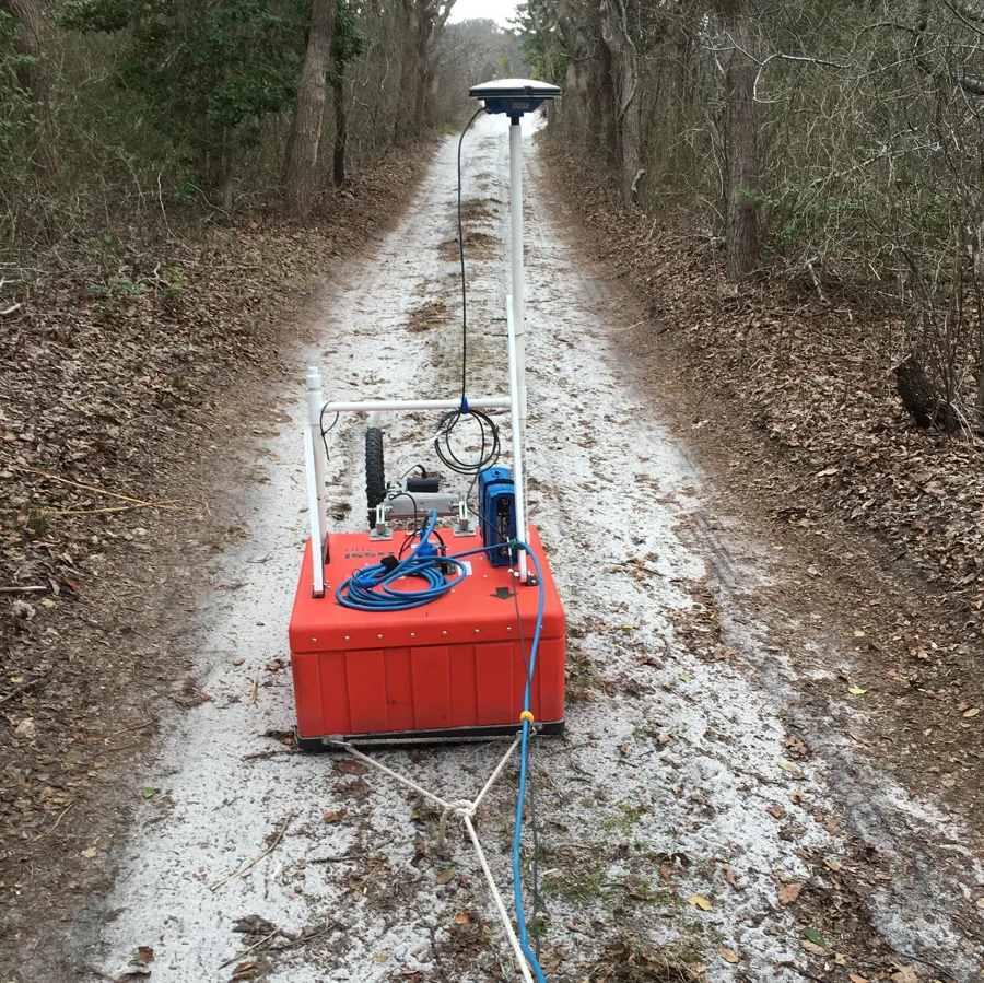
Every acoustic subsurface method covered elsewhere on this site — sub-bottom profilers, multibeam backscatter, seismic reflection, electrical resistivity tomography's current-based approach — measures how a physical signal travels through and reflects off the earth. GPR does something categorically different: it transmits pulsed electromagnetic (radio-frequency) energy into the ground and measures what bounces back. The property it is sensitive to is the dielectric constant, a measure of how a material responds to an electric field, not its density or acoustic impedance. Whenever the transmitted radio pulse crosses a boundary between two materials with different dielectric constants — dry sand over wet sand, sand over clay, a buried channel infilled with different sediment than what surrounds it — some of that energy reflects back to the receiving antenna. The two-way travel time of that reflection, combined with the known (or calibrated) propagation velocity of radio waves through the material in question, is converted into a depth, in direct conceptual parallel to how an echosounder converts acoustic travel time into water depth.
That conceptual parallel is where the resemblance to acoustic methods ends, because the frequency-versus-penetration trade-off that GPR operators manage is governed by electromagnetic physics rather than acoustic physics, even though the shape of the trade-off will feel familiar to anyone who has chosen a sub-bottom profiler frequency. Lower-frequency antennas, roughly in the 25–250 MHz range, penetrate deeper — tens of metres is achievable in favourable, low-conductivity ground — at the cost of coarser resolution, while higher-frequency antennas in the 500–2600 MHz range resolve fine stratigraphic detail at shallow depth but lose most of their signal within a few metres. A commonly used practical compromise for coastal and archaeological work sits around 250 MHz, balancing enough penetration to see metres-deep stratigraphy against resolution fine enough to make out individual sedimentary layers.
The Reason Radar Belongs to the Beach and Not the Sea
The property that makes GPR most useful in the intertidal zone specifically is also its single hardest limitation, and the two are the same fact stated two ways: GPR works well on land and in fresh water, and it effectively stops working in salt water. Conductivity is the reason. Salt water is highly electrically conductive, and that conductivity absorbs and disperses radio-frequency energy far faster than the low-conductivity materials — dry sand, fresh water, unsaturated soil — where GPR performs best. Even short of full immersion, saturating sand with water measurably degrades performance: laboratory characterizations put a saturated sand's dielectric constant at roughly 25–30 (up sharply from its dry, air-filled state) with conductivity rising into the 10–100 mS/m range, both changes acting to attenuate the signal and shrink usable depth. Push that saturating water from fresh to saline and the effect compounds sharply. This is precisely why GPR is not a subtidal survey tool competing with multibeam or side-scan sonar for seafloor coverage — it is a low-tide instrument, walked, towed, or driven across ground that is exposed, or at most freshwater-saturated, during the survey window, which is why intertidal beaches, barrier islands, and dune fields are its natural working environment rather than a limitation to work around.
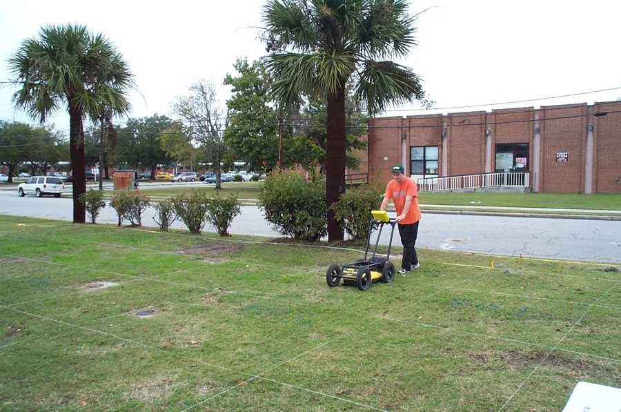
That same sensitivity to conductivity, framed as a strength rather than a limitation, is what makes GPR a genuinely useful tool for tracking saltwater intrusion into coastal freshwater aquifers. The boundary between fresh groundwater and underlying or encroaching saline groundwater is, in the words of researchers who have imaged it, "a dramatic event on a GPR section" — the sharp increase in electrical conductivity at that interface causes a correspondingly sharp drop in reflected-signal amplitude, producing a distinct, mappable horizon on the radar profile that traces the shape of the fresh-saline interface far more efficiently than a grid of boreholes could. Because that same physical response is diagnostic rather than merely an obstacle, GPR is frequently paired directly with electrical resistivity tomography surveys along the same transect lines — ERT's current-injection approach mapping bulk subsurface resistivity across a longer profile, GPR filling in higher-resolution structural detail closer to the surface — to confirm the pathway saline water is taking into a freshwater-bearing coastal aquifer.
Reading Storm History and Tsunami Deposits in the Sand
One of GPR's most established applications in coastal science is reading the buried record of past storms and tsunamis directly out of a beach's sedimentary layering — a record that is otherwise invisible without extensive trenching. High-resolution GPR surveys are commonly used across beach-ridge sequences and barrier islands specifically to image overwash sand lenses and erosional scarps, the physical signatures a storm or tsunami leaves behind when it pushes sand landward over an existing beach ridge and cuts an erosional surface into the sediment beneath it. On Phra Thong Island, Thailand, 500 MHz GPR surveys identified erosional features on the lee side of a beach ridge together with the associated depositional sand sheet inland of it, and sediment cores drilled along the same lines allowed the radar's reflection packets to be directly correlated with tsunami deposits left by the 2004 Indian Ocean tsunami as well as earlier, older paleotsunami events recorded in the same stratigraphy. A comparable approach in the Shetland Islands, UK, used GPR to trace deposits attributed to the Storegga Slide tsunami and other ancient sand sheets, with a basal sand layer at one site radiocarbon-dated to 426–787 CE. In the United States, a multi-year USGS study at Pea Island, North Carolina, combined meteorological records, aerial photography, lidar, GPR profiling, and sediment cores and trenches to identify and date washover deposits left specifically by Hurricanes Isabel (2003), Irene (2011), and Sandy (2012) — turning a barrier island's internal sand structure into a dated catalogue of the individual storms that reshaped it.
A Narrow Window, Precisely Filled
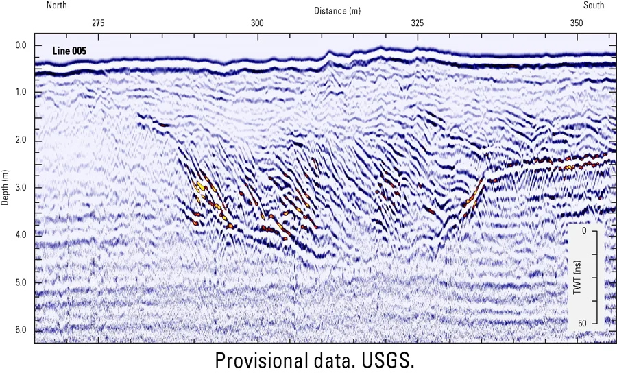
GPR will never replace a multibeam echosounder in open water, and it has no real prospect of working through more than the thinnest film of saline water once the tide comes back in. That narrowness is not a shortcoming to be engineered around — it is what makes GPR the right instrument for a specific, recurring problem in coastal survey: characterizing the shallow subsurface of a beach, dune field, or barrier island during the window when it is dry or fresh-water-saturated, whether the goal is dating storm and tsunami deposits buried in the sand, mapping the geometry of a buried paleochannel, or tracing how far saline water has advanced into a coastal aquifer. Every one of those questions sits in exactly the terrain — and exactly the tide state — where an acoustic instrument would struggle and a radio-frequency one does its best work.
References
- U.S. Environmental Protection Agency, "Ground Penetrating Radar (GPR)," https://www.epa.gov/environmental-geophysics/ground-penetrating-radar-gpr
- Woods Hole Oceanographic Institution, Coastal Systems Group, "Ground Penetrating Radar," https://www2.whoi.edu/site/coastalgroup/about/how-we-work/field-methods/ground-penetrating-radar/
- ScienceDirect, "Ground-penetrating radar (GPR) in coastal hazard studies," https://www.sciencedirect.com/science/article/pii/B9780128156865000080
- Bess Utility Solutions, "How Soil Conditions Affect GPR Accuracy," https://www.bessutilitysolutions.com/blog/how-soil-conditions-affect-gpr-accuracy/
- Sensoft GPR, "Saltwater Infiltration," case study, https://www.sensoft.ca/case-studies/saltwater-infiltration/
- Springer Nature, Environmental Earth Sciences, "Application of ERT and GPR for demarcating the saline water intrusion in coastal aquifers of Southern India," https://link.springer.com/article/10.1007/s12665-015-5207-8
- ScienceDirect, "Ground penetrating radar examination of thin tsunami beds — A case study from Phra Thong Island, Thailand," https://www.sciencedirect.com/science/article/abs/pii/S0037073815002043
- ResearchGate, "Using ground-penetrating radar (GPR) to investigate deposits from the Storegga Slide Tsunami and other sand-sheets in the Shetland Islands, UK," https://www.researchgate.net/publication/375881998_Using_ground-penetrating_radar_GPR_to_investigate_deposits_from_the_Storegga_Slide_Tsunami_and_other_sand-sheets_in_the_Shetland_Islands_UK
- ResearchGate, "Hurricane Overwash and Decadal-Scale Evolution of a Narrowing Barrier Island, Ocracoke Island, NC," https://www.researchgate.net/publication/323790227_Hurricane_Overwash_and_Decadal-Scale_Evolution_of_a_Narrowing_Barrier_Island_Ocracoke_Island_NC
- U.S. Geological Survey, "Ground-Penetrating Radar (GPR) Data Shows Buried Channel," Sound Waves Newsletter, February 17, 2021, https://www.usgs.gov/media/images/ground-penetrating-radar-gpr-data-shows-buried-channel
Related Articles
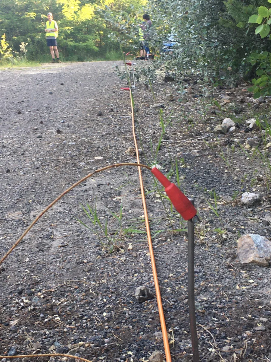
Electrical Resistivity Tomography: Mapping the Seabed With Current Instead of Sound
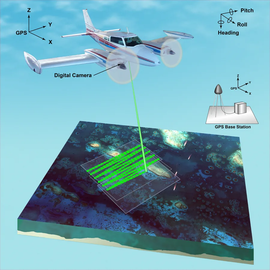
Airborne Lidar Bathymetry vs. Acoustic Echosounders: Choosing the Right Way to Measure Depth