Hidrografi
Submarine Telecommunications Cable Route Survey: From Desktop Study to Burial Assessment
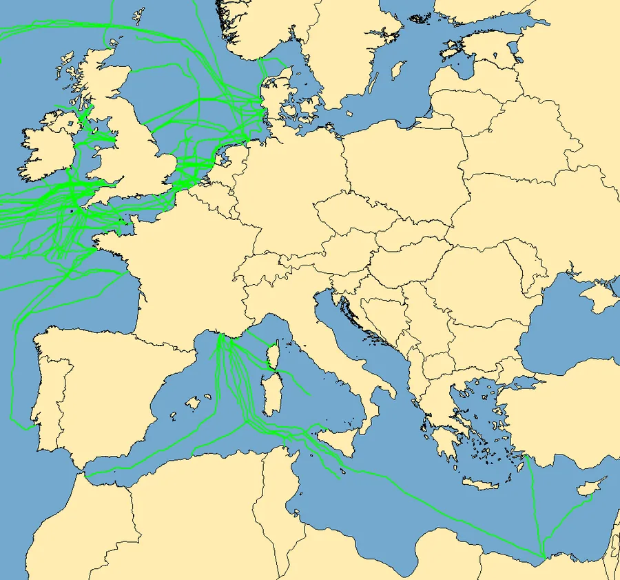
More than 99% of intercontinental internet and telephone traffic travels through submarine telecommunications cables — thin fibre-optic lines, often no thicker than a garden hose, laid across ocean floors that few people ever see. Before a single kilometre of that cable goes into the water, its exact route has to be planned, surveyed, and verified in a process that starts at a desk, moves to a survey vessel, and only ends once the seabed itself has confirmed the route on paper is actually safe to build.
It Starts on a Desk, Not on a Ship
The first phase of any cable route project is the desktop study, which under International Cable Protection Committee (ICPC) Recommendation No. 9 has to pull together existing bathymetric charts, historical survey data, environmental and jurisdictional constraints, known subsea infrastructure, shipping lanes, and fishing activity before a single candidate route is proposed. The purpose is not to finalise a route but to narrow the realistic options down to a small number of alternatives worth actually taking a ship out to verify — because a route that looks clean on a nautical chart can still cross an active fishing ground, a fault line, or an existing pipeline that never showed up at that scale.
Verifying the Route: Geophysical Survey
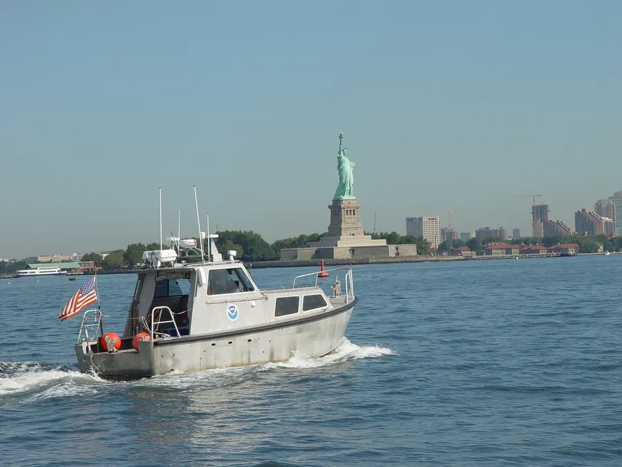
Each candidate route from the desktop study then gets a geophysical survey, run from a vessel using multibeam echosounders and side-scan sonar for detailed seabed mapping, often alongside sub-bottom profilers to characterise what lies just beneath the surface sediment. This phase is what turns a route from a line on a screen into a corridor with a known bathymetric profile, known seabed hazards, and known obstructions — the same category of survey data used across hydrographic charting more broadly, just aimed specifically at a single narrow corridor rather than an open area.
Ground-Truthing With Geotechnical Data
Geophysical data alone cannot confirm what the seabed is actually made of, which is why a burial assessment survey follows using cone penetration tests (CPTs) and sediment coring along the route. This geotechnical phase ground-truths the geophysical interpretation — confirming sediment type, strength, and stability — and its results directly finalise the burial assessment survey and the target burial depth for the cable along each section of the route.
Why Telecom Cable Requirements Differ From Power Cable
Submarine telecommunications cables and submarine power cables share a lot of survey methodology, but the engineering problem each one is solving is different. Power cables carry electrical current — commonly in the tens of kilovolts up to several hundred kilovolts HVDC — and generate heat that has to dissipate through the surrounding sediment, which makes burial depth partly a thermal question. Telecom cables carry signal, not current, using optical fibre and repeaters to amplify the signal over distance rather than converter stations; their design and survey requirements are driven far more by mechanical protection and repeater spacing than by heat dissipation. Telecom cables also tend to run far longer distances, connecting continents rather than an island to the mainland, which is part of why their route surveys have to account for a wider range of seabed geology and jurisdictional crossings along a single system.
Case in Point: Indonesia's Palapa Ring
Indonesia's Palapa Ring project is a national-scale example of what submarine telecom cable route work looks like at scale: a domestic fibre-optic backbone connecting provinces across the archipelago with more than 35,000 kilometres of submarine cable and over 21,000 kilometres of inland cable. Its eastern segment — linking West Papua, East Nusa Tenggara, Maluku, and Papua, some of the most logistically difficult and least-connected regions in the country — was completed on 14 October 2019. Route work across an archipelago like Indonesia's has to account for numerous strait crossings, varied seabed geology from shallow reef flats to deep interisland trenches, and existing maritime traffic, all identified during the same desktop-to-geotechnical sequence used on any other cable system, just repeated across many more route segments than a single point-to-point transoceanic cable would need.
The Route Is Only as Good as the Survey Behind It
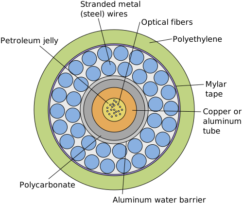
A cable system that will carry a meaningful share of a country's or a continent's internet traffic for the next twenty-five years is only as reliable as the route survey that sited it. Every kilometre of steel wire armouring, every burial depth specification, and every decision to route around a hazard rather than through it traces back to the same three-phase sequence — desk, geophysics, geotechnics — that turns an ocean's worth of uncertainty into a route a cable-laying ship can actually follow.
References
- International Cable Protection Committee (ICPC), "Recommendation No. 9: Minimum Technical Requirements for a Desk Top Study," https://www.iscpc.org/publications/
- "Geophysical and Geotechnical Surveys for Submarine Cables Installations: Main Applications and Methods," ResearchGate, https://www.researchgate.net/publication/301231745_Geophysical_and_geotechnical_surveys_for_submarine_cables_installations_main_applications_and_methods
- Hydro International, "Subsea Cable Route Surveying," https://www.hydro-international.com/content/article/subsea-cable-route-surveying
- NPC Electric, "Submarine Power Cable vs Communication Cable: Key Differences," https://www.npcelectric.com/news/submarine-power-cable-vs-communication-cable-key-differences-explained.html
- "Submarine Cable Systems: A Review of Installation, Monitoring, and Maintenance Processes and Technologies," Processes (MDPI), https://www.mdpi.com/2227-9717/14/5/821
- SubTel Forum, "Indonesia Completes East Palapa Ring Project," https://subtelforum.com/indonesia-completes-east-palapa-ring-project/
Related Articles