Oseanografi
Site Survey for Tidal Stream Turbines: Reading the Current Before You Bolt Down the Foundation
Offshore wind foundation surveys are mostly a soils problem: what does the seabed sediment do under decades of cyclic loading. Tidal stream turbine surveys start from a different question entirely, because the sites that make sense for a tidal turbine tend to be the sites where sediment doesn't accumulate in the first place — fast, scoured channels where the seabed is often bare rock. A tidal energy site survey has to answer two separate questions with two different toolkits: is the current here strong enough and predictable enough to be worth building on, and is the bedrock beneath it something a turbine foundation can actually be anchored to.
The Resource Question: How Fast, How Often, How Deep
The International Electrotechnical Commission's IEC 62600-201 technical specification gives the industry a common methodology for tidal-stream resource assessment, aiming to reduce the wide uncertainty that used to exist between different developers' velocity and power-density estimates for the same stretch of water. In practice, that assessment starts by narrowing down candidate sites using depth, current speed, power density, turbulence, and wave climate, most often gathered from a mix of field measurement and hydrodynamic modelling. Current commercial-scale tidal-stream devices generally need spring-tide velocities above roughly 2.5 m/s and water depths between about 25 and 50 m to be viable — numbers that immediately rule out most of the coastline and narrow the search to a small number of physically constrained channels.
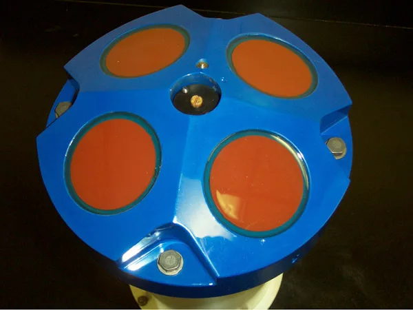
Field measurement for this stage relies heavily on Acoustic Doppler Current Profilers, typically deployed seabed-mounted at the narrows of a candidate channel alongside tide gauges, sometimes supplemented by semi-stationary vessel-mounted ADCP passes to fill in spatial gaps a single fixed mooring can't cover. At the European Marine Energy Centre's Fall of Warness test site off Eday, Orkney — chosen for currents that reach almost 4 m/s at spring tide — RDI Workhorse Sentinel 600 kHz seabed-mounted ADCPs were deployed for a 31-day measurement window in October–November 2007 as part of the site's broader characterization effort, data that fed directly into flow-model calibration and validation work carried out under the UK's ReDAPT programme.
Case Study: A Channel Built on Scoured Bedrock
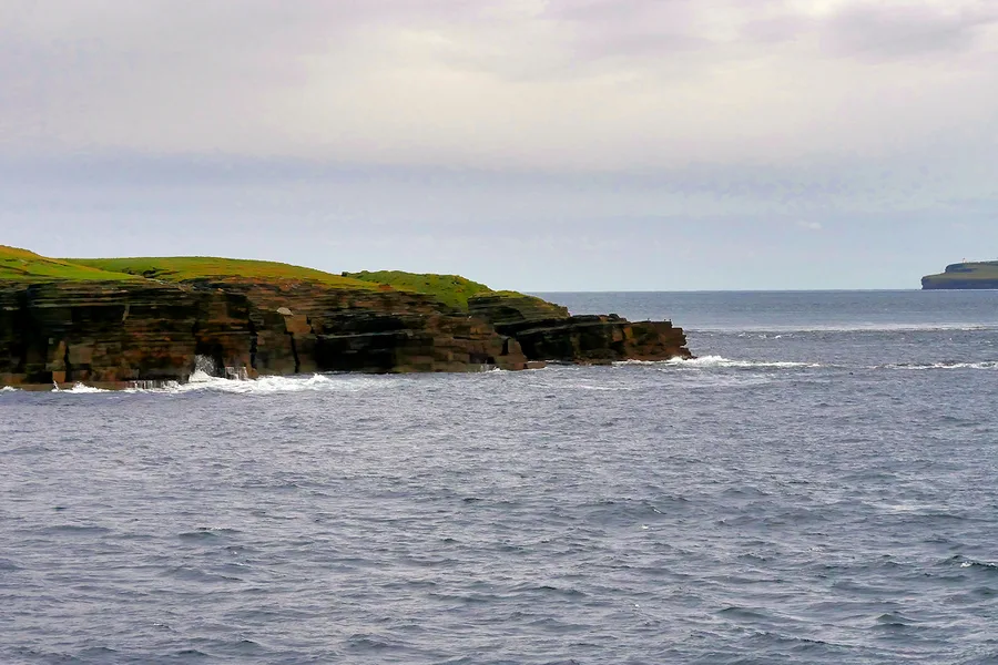
The MeyGen project in the Inner Sound of the Pentland Firth, between the Scottish mainland and the island of Stroma, was selected after site evaluation identified it as the best location in the Firth for initial commercial development — a channel where the seabed reaches 48.6 m at its deepest point, with the turbines themselves sited in the 31.5–38 m depth range at Lowest Astronomical Tide and maximum current speeds of up to 5 m/s. Site survey work found the majority of the Inner Sound's seabed to be scoured bedrock with a distinctive "saw-tooth" profile — the direct signature of years of fast tidal flow stripping away anything loose. That finding shaped the entire foundation design: MeyGen's turbines, 18 m-diameter three-bladed machines fully submerged and installed in winter 2016/17, sit on individual gravity-base foundations weighing 250–350 tonnes each, paired with six ballast blocks totalling 1,200 tonnes for horizontal stability — a foundation strategy built around resting weight on hard rock rather than piling into soft sediment.

Case Study: When the Survey Finds the Scour Itself
In the Bay of Fundy's Minas Passage, a systematic multibeam sonar survey of the entire bay — published by the Geological Survey of Canada as seventeen 1:50,000-scale maps in 2011 — mapped the scour features that would later inform the siting of the Fundy Ocean Research Center for Energy (FORCE) test facility. The survey found scour troughs covering roughly 240 km² with a combined volume of about 5 km³: steep-sided depressions cut directly into the seabed by the Bay's exceptionally strong tidal flow. The pilot berth ultimately selected sits at about 45 m depth on a sediment-free bedrock floor with straight, unobstructed flow — exactly the combination the survey was designed to find, and a useful illustration that in tidal energy siting, the geophysical survey isn't just checking for hazards to avoid, it's actively mapping the process that created the resource in the first place.
Two Surveys, One Site
A tidal stream project only gets built where a resource survey and a seabed survey agree — fast, deep, predictable current layered directly over ground a foundation can actually be fixed to. That overlap is narrow by nature, which is part of why global tidal-stream development remains concentrated in a small number of channels like the Pentland Firth and the Bay of Fundy rather than spread thinly across every energetic strait on the map. Getting the site right the first time, with both surveys done properly, matters more here than in almost any other class of offshore renewable structure: relocating a gravity-base foundation off scoured bedrock is not a correction anyone budgets for twice.
References
- "Hydrokinetic Tidal Energy Resource Assessment Following International Electrotechnical Commission Guidelines," OSTI, https://www.osti.gov/pages/servlets/purl/2476676
- "A Review of Global Tidal Stream Energy Resources," Proceedings of the Royal Society A, https://royalsocietypublishing.org/rspa/article/481/2328/20240841/366128/A-review-of-global-tidal-stream-energy-resourcesA
- Scottish Government Marine Directorate, "MeyGen Tidal Energy Project — Chapter 5, Project Description," https://marine.gov.scot/sites/default/files/chapter_5_project_description_0.pdf
- MEDIN Discovery Metadata Portal, "EMEC — Fall of Warness, ADCP Data Series," https://portal.medin.org.uk/portal/?tpc=015_803cce3774479954cff7d7274eb9a12a
- "Anatomy of the Tidal Scour System at Minas Passage, Bay of Fundy, Canada," ScienceDirect, https://www.sciencedirect.com/science/article/abs/pii/S0025322712001582
Related Articles